List of State Register of Heritage Places in the Shire of Yilgarn
List of heritage sites in Western Australia
Map all coordinates using OpenStreetMap
Download coordinates as:
- KML
- GPX (all coordinates)
- GPX (primary coordinates)
- GPX (secondary coordinates)
The State Register of Heritage Places is maintained by the Heritage Council of Western Australia. As of 2023[update], 116 places are heritage-listed in the Shire of Yilgarn,[1] of which 15 are on the State Register of Heritage Places.[2]
List
The Western Australian State Register of Heritage Places, as of 2023[update], lists the following 15 state registered places within the Shire of Yilgarn:
| Place name | Place # | Street number | Street name | Suburb or town | Co-ordinates | Notes & former names | Photo |
|---|---|---|---|---|---|---|---|
| No. 6 Steam Pumping Station (former), Ghooli | 2789 | Great Eastern Highway | Ghooli | 31°15′16″S 119°27′24″E / 31.254388°S 119.456621°E / -31.254388; 119.456621 (No. 6 Steam Pumping Station (former), Ghooli) |  | ||
| Our Lady of Montserrat, Southern Cross | 2801 | 50 | Altair Street | Southern Cross | 31°13′48″S 119°19′27″E / 31.229922°S 119.324169°E / -31.229922; 119.324169 (Our Lady of Montserrat, Southern Cross) | Domus Di, St Joseph's Catholic Church |  |
| Court House & Registrar's Office (former) | 2804 | 26 | Antares Street | Southern Cross | 31°13′54″S 119°19′40″E / 31.23158°S 119.327688°E / -31.23158; 119.327688 (Court House & Registrar's Office) | Yilgarn History Museum |  |
| Police Lock-up (former) | 2806 | Antares Street | Southern Cross | 31°13′53″S 119°19′36″E / 31.231524°S 119.326793°E / -31.231524; 119.326793 (Police Lock-up) | |||
| Southern Cross Post Office | 2808 | 24 | Antares Street | Southern Cross | 31°13′54″S 119°19′40″E / 31.231789°S 119.327838°E / -31.231789; 119.327838 (Southern Cross Post Office) |  | |
| Palace Hotel, Southern Cross | 2812 | 6 | Orion Street | Southern Cross | 31°14′02″S 119°19′47″E / 31.233851°S 119.329637°E / -31.233851; 119.329637 (Palace Hotel, Southern Cross) | Anniversary Hostel |  |
| Masonic Hall (former), Southern Cross | 2815 | 14 | Spica Street | Southern Cross | 31°13′55″S 119°19′48″E / 31.231983°S 119.330023°E / -31.231983; 119.330023 (Masonic Hall (former), Southern Cross) | Masonic Temple | |
| Koorarawalyee Tank | 5977 | Great Eastern Highway | Mount Palmer | 31°16′12″S 120°00′18″E / 31.269942°S 120.004981°E / -31.269942; 120.004981 (Koorarawalyee Tank) | Part of the Goldfields Water Supply Scheme precinct (16610) | ||
| Old Primary School, Southern Cross | 10022 | 28 | Antares Street | Southern Cross | 31°13′50″S 119°19′36″E / 31.230552°S 119.326758°E / -31.230552; 119.326758 (Old Primary School, Southern Cross) | Forrester Resource Centre, Old State School | |
| Bodallin Railway Dam | 10055 | 4 km West of Bodallin | Bodallin | 31°23′39″S 118°47′45″E / 31.39426°S 118.795881°E / -31.39426; 118.795881 (Bodallin Railway Dam) | Part of the Railway Rock Catchment Dam Group, Yilgarn Precinct (25378) | ||
| Karalee Reservoir, Rock Catchment & Aqueduct | 10062 | about 50 km East of Southern Cross | Southern Cross | 31°15′42″S 119°49′56″E / 31.261647°S 119.832322°E / -31.261647; 119.832322 (Karalee Reservoir, Rock Catchment & Aqueduct) |  | ||
| Yellowdine Catchment & Dams | 10069 | Reserve 3229 | Yellowdine | 31°17′14″S 119°38′21″E / 31.287162°S 119.639137°E / -31.287162; 119.639137 (Yellowdine Catchment & Dams) | Part of the Railway Rock Catchment Dam Group, Yilgarn Precinct (25378) | ||
| Goldfields Water Supply Scheme | 16610 | Listed under the Coolgardie, Cunderdin, Kellerberrin, Kalgoorlie–Boulder, Merredin, Mundaring, Northam, Tammin and Yilgarn State Heritage lists | Stretches from Mundaring Weir in Perth to the Eastern Goldfields, particularly Coolgardie and Kalgoorlie | 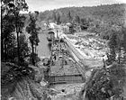 | |||
| Stone Bread Oven | 16795 | Yerbillon | 31°23′38″S 118°48′10″E / 31.393927°S 118.802895°E / -31.393927; 118.802895 (Stone Bread Oven) | Part of the Railway Rock Catchment Dam Group, Yilgarn Precinct (25378) | |||
| Railway Rock Catchment Dam Group, Yilgarn | 25378 | Stephens Road | Bodallin | 31°17′14″S 119°38′21″E / 31.287162°S 119.639137°E / -31.287162; 119.639137 (Railway Rock Catchment Dam Group, Yilgarn) |
References
- v
- t
- e
Heritage places of Western Australia by local government area
| Overview | |
|---|---|
| Cities | |
| Towns | |
| Shires | |
| Islands |
- Beverley
- Brookton†
- Bruce Rock
- Chittering
- Corrigin
- Cuballing
- Cunderdin
- Dalwallinu
- Dandaragan†
- Dowerin†
- Dumbleyung†
- Gingin
- Goomalling
- Kellerberrin
- Kondinin
- Koorda†
- Kulin
- Lake Grace
- Merredin
- Moora
- Mount Marshall†
- Mukinbudin†
- Narembeen
- Narrogin
- Northam
- Nungarin
- Pingelly
- Quairading
- Tammin†
- Toodyay
- Trayning
- Victoria Plains
- Wagin
- Wandering†
- West Arthur
- Westonia
- Wickepin
- Williams
- Wongan-Ballidu
- Wyalkatchem
- Yilgarn
- York (Town of York • Shire of York)
| Organisations | |
|---|---|
| Register |
| Current |
|
|---|---|
| Former | |
^† Denotes LGA without State Heritage Listed Places | |


