National Register of Historic Places listings in Fayette County, Kentucky
This is a list of the National Register of Historic Places listings in Fayette County, Kentucky.
This is intended to be a complete list of the properties and districts on the National Register of Historic Places in Fayette County, Kentucky, United States. The locations of National Register properties and districts for which the latitude and longitude coordinates are included below, may be seen in a map.[1]
There are 179 properties and districts listed on the National Register in the county, of which 3 are National Historic Landmarks. Another 3 properties were once listed but have been removed.
This National Park Service list is complete through NPS recent listings posted September 5, 2024.[2]
John Hunt Morgan Memorial and John C. Breckinridge Memorial moved to Lexington Cemetery July, 2018.[3]
Map all coordinates using OpenStreetMap
Download coordinates as:
- KML
- GPX (all coordinates)
- GPX (primary coordinates)
- GPX (secondary coordinates)
Current listings
| [4] | Name on the Register | Image | Date listed[5] | Location | City or town | Description |
|---|---|---|---|---|---|---|
| 1 | African Cemetery No. 2 |  | March 31, 2004 (#04000245) | 419 E. 7th St. 38°03′04″N 84°28′41″W / 38.051111°N 84.478056°W / 38.051111; -84.478056 (African Cemetery No. 2) | Lexington | |
| 2 | James Allen House |  | December 30, 1982 (#82001564) | 1020 Lane Allen Rd. 38°01′54″N 84°33′10″W / 38.031667°N 84.552778°W / 38.031667; -84.552778 (James Allen House) | Lexington | |
| 3 | Ashland | 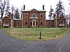 | October 15, 1966 (#66000357) | 2 miles (3.2 km) southeast of downtown Lexington on Richmond Rd. 38°01′43″N 84°28′48″W / 38.028611°N 84.48°W / 38.028611; -84.48 (Ashland) | Lexington | |
| 4 | Ashland Park Historic District |  | March 31, 1986 (#86000755) | Roughly bounded by Ashland Ave., Richmond Rd., Chinoe Rd., and Fontaine Rd. 38°01′45″N 84°28′56″W / 38.029167°N 84.482222°W / 38.029167; -84.482222 (Ashland Park Historic District) | Lexington | |
| 5 | Athens Historic District | Upload image | October 11, 1979 (#79000971) | Athens-Boonesboro Pike 37°56′58″N 84°21′53″W / 37.949444°N 84.364722°W / 37.949444; -84.364722 (Athens Historic District) | Athens | |
| 6 | Abraham Barton House |  | August 26, 1977 (#77000611) | 200 N. Upper St. 38°02′56″N 84°29′42″W / 38.048889°N 84.495000°W / 38.048889; -84.495000 (Abraham Barton House) | Lexington | |
| 7 | T.D. Basye House | 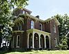 | October 22, 1987 (#87001886) | 3501 Georgetown Rd. 38°07′36″N 84°31′38″W / 38.126667°N 84.527222°W / 38.126667; -84.527222 (T.D. Basye House) | Lexington | |
| 8 | Bates Log House | Upload image | August 26, 1982 (#82002683) | 5143 Spurr Rd. 38°07′10″N 84°34′11″W / 38.11941°N 84.56977°W / 38.11941; -84.56977 (Bates Log House) | Lexington | Exceptionally large log house built c.1800. |
| 9 | James Burnie Beck House |  | August 26, 1982 (#82002684) | 209 E. High St. 38°02′35″N 84°29′46″W / 38.043056°N 84.496111°W / 38.043056; -84.496111 (James Burnie Beck House) | Lexington | |
| 10 | Bell Court Neighborhood Historic District | 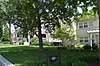 | December 8, 1980 (#80001507) | Roughly bounded by railroad tracks, Main St., Boonesboro and Walton Aves. 38°02′22″N 84°29′09″W / 38.039444°N 84.485833°W / 38.039444; -84.485833 (Bell Court Neighborhood Historic District) | Lexington | |
| 11 | Bell Place |  | February 17, 1978 (#78001312) | Sayre Ave. 38°02′20″N 84°29′09″W / 38.038889°N 84.485833°W / 38.038889; -84.485833 (Bell Place) | Lexington | |
| 12 | John Bell House | Upload image | June 23, 1983 (#83002757) | Kentucky Route 1978 38°04′59″N 84°31′48″W / 38.083056°N 84.53°W / 38.083056; -84.53 (John Bell House) | Lexington | |
| 13 | Boone Creek Rural Historic District | Upload image | August 19, 1994 (#94000839) | Roughly bounded by Interstate 75, Cleveland Rd., Athens-Boonesboro Rd. and Grimes Rd. 37°56′21″N 84°21′51″W / 37.939167°N 84.364167°W / 37.939167; -84.364167 (Boone Creek Rural Historic District) | Lexington vicinity | Extends into Clark County |
| 14 | Botherum |  | March 7, 1973 (#73000795) | 341 Madison Pl. 38°02′59″N 84°30′26″W / 38.049722°N 84.507222°W / 38.049722; -84.507222 (Botherum) | Lexington | |
| 15 | Bowman Houses | Upload image | August 9, 1979 (#79000973) | West of Lexington on Bowman's Mill Rd. 38°00′31″N 84°35′55″W / 38.008611°N 84.598611°W / 38.008611; -84.598611 (Bowman Houses) | Lexington | |
| 16 | Bowman Mill Road Rural Historic District | Upload image | July 28, 1999 (#99000901) | Bowman Mill Rd., Parkers Mill Rd., and Cave Hill Ln. 38°00′48″N 84°35′56″W / 38.013333°N 84.598889°W / 38.013333; -84.598889 (Bowman Mill Road Rural Historic District) | Lexington | |
| 17 | Brand-Barrow House |  | August 11, 1976 (#76000866) | 203 E. 4th St. 38°02′58″N 84°29′18″W / 38.049444°N 84.488333°W / 38.049444; -84.488333 (Brand-Barrow House) | Lexington | |
| 18 | John C. Breckinridge Memorial |  | July 17, 1997 (#97000705) | Courthouse Lawn, junction of N. Upper and E. Main Sts. 38°02′52″N 84°29′54″W / 38.047778°N 84.498417°W / 38.047778; -84.498417 (John C. Breckinridge Memorial) | Lexington | |
| 19 | Joshua Brown House |  | December 27, 1979 (#79000974) | 2705 Tates Creek Rd. 38°00′43″N 84°29′47″W / 38.011944°N 84.496389°W / 38.011944; -84.496389 (Joshua Brown House) | Lexington | |
| 20 | Buenna Hill | Upload image | June 29, 1983 (#83002758) | Off Ferguson Rd. 38°10′22″N 84°24′18″W / 38.172778°N 84.405°W / 38.172778; -84.405 (Buenna Hill) | Centerville | |
| 21 | John Burrier House | Upload image | June 23, 1983 (#83002759) | Kentucky Route 1966 38°00′47″N 84°37′14″W / 38.013056°N 84.620556°W / 38.013056; -84.620556 (John Burrier House) | Lexington | |
| 22 | Cadentown School | 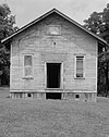 | April 5, 2006 (#06000213) | 705 Caden Ln. 38°00′38″N 84°25′48″W / 38.010556°N 84.43°W / 38.010556; -84.43 (Cadentown School) | Lexington | |
| 23 | Cave Place | Upload image | December 5, 1980 (#80001508) | West of Lexington 38°01′07″N 84°35′04″W / 38.018611°N 84.584444°W / 38.018611; -84.584444 (Cave Place) | Lexington | |
| 24 | Cave Spring | Upload image | December 22, 1978 (#78001313) | Southeast of Lexington off U.S. Route 25 37°56′53″N 84°23′48″W / 37.948056°N 84.396667°W / 37.948056; -84.396667 (Cave Spring) | Lexington | |
| 25 | Central Christian Church |  | September 11, 1979 (#79000975) | 207 E. Short St. 38°02′44″N 84°29′39″W / 38.045556°N 84.494167°W / 38.045556; -84.494167 (Central Christian Church) | Lexington | |
| 26 | Central Kentucky Blue Grass Seed Co. |  | August 3, 2005 (#05000790) | 321 Henry St. 38°03′28″N 84°30′01″W / 38.057639°N 84.500278°W / 38.057639; -84.500278 (Central Kentucky Blue Grass Seed Co.) | Lexington | |
| 27 | Chandler Normal School Building and Webster Hall | 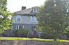 | December 4, 1980 (#80001509) | 548 Georgetown St. 38°03′50″N 84°30′07″W / 38.063889°N 84.501944°W / 38.063889; -84.501944 (Chandler Normal School Building and Webster Hall) | Lexington | |
| 28 | Christ Church Episcopal | 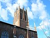 | October 21, 1976 (#76000867) | Church and Market Sts. 38°02′55″N 84°29′48″W / 38.048611°N 84.496667°W / 38.048611; -84.496667 (Christ Church Episcopal) | Lexington | |
| 29 | Clark Hardware Company Building |  | July 16, 1979 (#79000976) | 367-369 W. Short St. and 142 N. Broadway 38°02′58″N 84°29′56″W / 38.049444°N 84.498889°W / 38.049444; -84.498889 (Clark Hardware Company Building) | Lexington | |
| 30 | John Clark House | 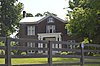 | November 25, 1980 (#80001510) | Tates Creek Pk. 38°00′47″N 84°29′36″W / 38.013056°N 84.493333°W / 38.013056; -84.493333 (John Clark House) | Lexington | |
| 31 | Henry Clay's Law Office | 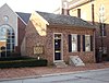 | March 11, 1971 (#71000340) | 176 N. Mill St. 38°02′58″N 84°29′49″W / 38.049444°N 84.496944°W / 38.049444; -84.496944 (Henry Clay's Law Office) | Lexington | |
| 32 | Cleveland-Rogers House | Upload image | August 26, 1980 (#80001511) | Lexington at 8151 Richmond Rd. 37°54′09″N 84°21′14″W / 37.9025°N 84.353889°W / 37.9025; -84.353889 (Cleveland-Rogers House) | Lexington | |
| 33 | Cloud House | 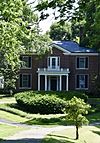 | June 17, 1982 (#82002685) | 3740 Versailles Rd. 38°02′03″N 84°35′17″W / 38.034167°N 84.588056°W / 38.034167; -84.588056 (Cloud House) | Lexington | |
| 34 | William Conant House | Upload image | February 22, 1991 (#91000123) | 1701 Elkchester Rd. 38°04′42″N 84°36′25″W / 38.078333°N 84.606944°W / 38.078333; -84.606944 (William Conant House) | Lexington | |
| 35 | Confederate Soldier Monument in Lexington |  | July 17, 1997 (#97000703) | 833 W. Main St. 38°03′31″N 84°30′41″W / 38.058611°N 84.511250°W / 38.058611; -84.511250 (Confederate Soldier Monument in Lexington) | Lexington | |
| 36 | Constitution Historic District | 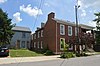 | August 30, 1982 (#82002686) | Roughly bounded by E. 3rd., Limestone, Walnut, and Pleasant Stone Sts. 38°02′54″N 84°29′31″W / 38.048333°N 84.491944°W / 38.048333; -84.491944 (Constitution Historic District) | Lexington | |
| 37 | Corinthia | Upload image | June 29, 1983 (#83002760) | Off Lemons Mill Rd. 38°10′22″N 84°24′50″W / 38.172778°N 84.413889°W / 38.172778; -84.413889 (Corinthia) | Centerville | |
| 38 | DeLong Agricultural Implements Warehouse | 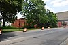 | November 25, 1980 (#80001512) | Patterson St. 38°03′00″N 84°30′12″W / 38.050000°N 84.503333°W / 38.050000; -84.503333 (DeLong Agricultural Implements Warehouse) | Lexington | Four-story brick warehouse; no longer extant |
| 39 | Delta | Upload image | August 10, 1978 (#78001314) | South of Lexington at 2450 Armstrong Mill Rd. 37°57′08″N 84°27′57″W / 37.952222°N 84.465833°W / 37.952222; -84.465833 (Delta) | Lexington | |
| 40 | Douglass School |  | August 14, 1998 (#98000933) | 465 Price Rd. 38°04′12″N 84°30′22″W / 38.07°N 84.506111°W / 38.07; -84.506111 (Douglass School) | Lexington | |
| 41 | Downtown Commercial District | 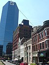 | August 25, 1983 (#83000559) | Roughly bounded by Main, Church, Walnut Sts., and Broadway 38°02′50″N 84°29′50″W / 38.047222°N 84.497222°W / 38.047222; -84.497222 (Downtown Commercial District) | Lexington | |
| 42 | Edgewood | Upload image | August 4, 2016 (#16000494) | 5910 Winchester Rd. 38°01′46″N 84°18′20″W / 38.029556°N 84.305593°W / 38.029556; -84.305593 (Edgewood) | Lexington | |
| 43 | Elam Mound Archeological Site | Upload image | October 10, 1975 (#75000749) | Address Restricted | Lexington | |
| 44 | Elley Villa |  | January 9, 1978 (#78001315) | 320 Linden Walk 38°02′17″N 84°29′48″W / 38.038056°N 84.496667°W / 38.038056; -84.496667 (Elley Villa) | Lexington | |
| 45 | Elmendorf | Upload image | March 14, 2023 (#100008737) | 611 and 639 Iron Works Pike, 3931 Paris Pike 38°06′38″N 84°25′21″W / 38.1105°N 84.4224°W / 38.1105; -84.4224 (Elmendorf) | Lexington | |
| 46 | Elsmere Park Historic District | 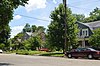 | April 26, 1976 (#76000868) | Off N. Broadway, between W. 6th and 7th Sts. 38°03′22″N 84°29′13″W / 38.056111°N 84.486944°W / 38.056111; -84.486944 (Elsmere Park Historic District) | Lexington | |
| 47 | Episcopal Burying Ground and Chapel | 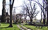 | June 24, 1976 (#76000869) | 251 E. 3rd St. 38°02′49″N 84°29′21″W / 38.046944°N 84.489167°W / 38.046944; -84.489167 (Episcopal Burying Ground and Chapel) | Lexington | |
| 48 | Fairlawn | Upload image | October 14, 1976 (#76000870) | 6 miles (9.7 km) northeast of Lexington on U.S. Route 68 38°06′55″N 84°23′34″W / 38.115278°N 84.392778°W / 38.115278; -84.392778 (Fairlawn) | Lexington | |
| 49 | Fayette National Bank Building | 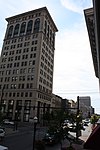 | February 27, 1980 (#80001513) | 159-167 W. Main St. 38°02′50″N 84°29′53″W / 38.047222°N 84.498056°W / 38.047222; -84.498056 (Fayette National Bank Building) | Lexington | |
| 50 | Fayette Safety Vault and Trust Company Building |  | August 11, 1980 (#80001514) | 111-113 Cheapside St. 38°02′53″N 84°29′54″W / 38.048194°N 84.498472°W / 38.048194; -84.498472 (Fayette Safety Vault and Trust Company Building) | Lexington | |
| 51 | Featherston, Edmonson and Clark Houses |  | July 21, 1983 (#83002761) | 218, 226, and 232 E. Maxwell St. 38°02′26″N 84°29′55″W / 38.040556°N 84.498611°W / 38.040556; -84.498611 (Featherston, Edmonson and Clark Houses) | Lexington | |
| 52 | First African Baptist Church |  | April 24, 1986 (#86000854) | 264-272 E. Short St. 38°02′38″N 84°29′35″W / 38.043889°N 84.493056°W / 38.043889; -84.493056 (First African Baptist Church) | Lexington | |
| 53 | First Presbyterian Church, Lexington |  | December 30, 1974 (#74000861) | 174 N. Mill St. 38°02′57″N 84°29′49″W / 38.049167°N 84.496944°W / 38.049167; -84.496944 (First Presbyterian Church, Lexington) | Lexington | |
| 54 | Floral Hall |  | August 29, 1977 (#77000612) | 847 S. Broadway 38°02′27″N 84°31′03″W / 38.040833°N 84.517500°W / 38.040833; -84.517500 (Floral Hall) | Lexington | |
| 55 | Monsieur Giron's Confectionary | 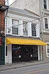 | December 27, 1974 (#74000866) | 125 N. Mill St. 38°02′55″N 84°29′54″W / 38.048611°N 84.498472°W / 38.048611; -84.498472 (Monsieur Giron's Confectionary) | Lexington | |
| 56 | George W. Grant House | Upload image | October 24, 1980 (#80001515) | 519 W. 4th St. 38°03′27″N 84°29′48″W / 38.0575°N 84.496667°W / 38.0575; -84.496667 (George W. Grant House) | Lexington | |
| 57 | Gratz Park Historic District |  | March 14, 1973 (#73000796) | Bounded by 2nd and 3rd Sts., the Byway, and Bark Alley 38°03′00″N 84°29′46″W / 38.05°N 84.496111°W / 38.05; -84.496111 (Gratz Park Historic District) | Lexington | Includes the Hunt–Morgan House. |
| 58 | Graves Tavern |  | June 23, 1983 (#83002766) | Off U.S. Route 60 38°02′28″N 84°37′37″W / 38.041111°N 84.626944°W / 38.041111; -84.626944 (Graves Tavern) | Versailles | |
| 59 | Grimes House and Mill Complex | Upload image | June 21, 1982 (#82002687) | Grimes Mill Rd. 37°54′57″N 84°20′34″W / 37.915833°N 84.342778°W / 37.915833; -84.342778 (Grimes House and Mill Complex) | Lexington | |
| 60 | Guilfoil Village Site (15FA176) | Upload image | December 5, 1985 (#85003063) | Address Restricted | Athens | |
| 61 | Hartland |  | April 2, 1987 (#87000568) | 2230 Armstrong Mill Rd. 37°57′35″N 84°28′21″W / 37.959722°N 84.4725°W / 37.959722; -84.4725 (Hartland) | Lexington | |
| 62 | Samuel T. Hayes House | Upload image | March 19, 1980 (#80001516) | Southeast of Lexington on Sulphur Well Rd. 37°58′57″N 84°21′23″W / 37.9825°N 84.356389°W / 37.9825; -84.356389 (Samuel T. Hayes House) | Lexington | |
| 63 | George Headley House | Upload image | March 4, 1991 (#91000122) | 4435 Old Frankfort Pike 38°05′42″N 84°36′34″W / 38.095°N 84.609444°W / 38.095; -84.609444 (George Headley House) | Lexington | |
| 64 | Hal Price Headley Sr. House |  | November 15, 2010 (#10000907) | 1236 Standish Way 38°02′35″N 84°33′44″W / 38.043056°N 84.562222°W / 38.043056; -84.562222 (Hal Price Headley Sr. House) | Lexington | |
| 65 | Helm Place | Upload image | August 3, 1978 (#78001318) | Southwest of Lexington on Bowman Mill Rd. 38°00′10″N 84°35′19″W / 38.002778°N 84.588611°W / 38.002778; -84.588611 (Helm Place) | Lexington | |
| 66 | Higgins Block |  | August 12, 1977 (#77000613) | 145-151 W. Main St. 38°02′49″N 84°29′52″W / 38.046944°N 84.497778°W / 38.046944; -84.497778 (Higgins Block) | Lexington | |
| 67 | Highland Hall |  | December 16, 1977 (#77000614) | 6208 Richmond Rd. 37°56′04″N 84°23′50″W / 37.934444°N 84.397222°W / 37.934444; -84.397222 (Highland Hall) | Lexington | |
| 68 | Hollywood Terrace Historic District | Upload image | July 8, 2008 (#08000652) | Tates Creek Rd. and the rear property lines of the properties facing Euclid, Tremont, and Park Ave. 38°01′33″N 84°29′29″W / 38.025833°N 84.491389°W / 38.025833; -84.491389 (Hollywood Terrace Historic District) | Lexington | |
| 69 | Hurricane Hall | 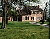 | April 22, 1976 (#76000871) | North of Lexington off U.S. Route 25 38°08′09″N 84°32′11″W / 38.135833°N 84.536389°W / 38.135833; -84.536389 (Hurricane Hall) | Lexington | |
| 70 | Innes House | Upload image | June 29, 1983 (#83002762) | Off Lemons Mill Rd. 38°10′23″N 84°24′30″W / 38.173056°N 84.408333°W / 38.173056; -84.408333 (Innes House) | Centerville | |
| 71 | Thomas January House |  | December 27, 1974 (#74000862) | 437 W. 2nd St. 38°03′08″N 84°29′54″W / 38.052222°N 84.498333°W / 38.052222; -84.498333 (Thomas January House) | Lexington | |
| 72 | Keeneland-Keeneland Racetrack |  | September 24, 1986 (#86003487) | Off Versailles and Rice Rds. 38°02′57″N 84°36′22″W / 38.049167°N 84.606111°W / 38.049167; -84.606111 (Keeneland-Keeneland Racetrack) | Lexington | |
| 73 | Matthew Kennedy House |  | June 19, 1973 (#73000797) | 216 N. Limestone St. 38°02′54″N 84°29′37″W / 38.048472°N 84.493611°W / 38.048472; -84.493611 (Matthew Kennedy House) | Lexington | |
| 74 | Kinkead House |  | June 29, 1982 (#82002688) | 362 Walnut St. 38°02′56″N 84°29′19″W / 38.048889°N 84.488611°W / 38.048889; -84.488611 (Kinkead House) | Lexington | |
| 75 | Henry P. Kinkead House | 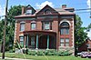 | July 12, 1984 (#84001411) | 403 N. Martin Luther King Blvd. 38°02′58″N 84°29′19″W / 38.049444°N 84.488611°W / 38.049444; -84.488611 (Henry P. Kinkead House) | Lexington | |
| 76 | The Ladies' Confederate Memorial | 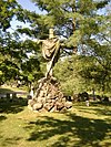 | July 17, 1997 (#97000706) | 833 W. Main St. 38°03′32″N 84°30′42″W / 38.058889°N 84.511667°W / 38.058889; -84.511667 (The Ladies' Confederate Memorial) | Lexington | |
| 77 | Lemon Hill | Upload image | November 20, 1978 (#78001319) | East of Lexington off U.S. Route 60 38°03′16″N 84°20′37″W / 38.054444°N 84.343611°W / 38.054444; -84.343611 (Lemon Hill) | Lexington | |
| 78 | James Lemon Houses |  | November 21, 1974 (#74000863) | 329-331 S. Mill St. 38°02′47″N 84°30′06″W / 38.046389°N 84.501667°W / 38.046389; -84.501667 (James Lemon Houses) | Lexington | |
| 79 | Lewis Manor | Upload image | April 26, 1976 (#76000872) | Northwest of Lexington on Viley Rd. 38°04′36″N 84°33′07″W / 38.076667°N 84.551944°W / 38.076667; -84.551944 (Lewis Manor) | Lexington | |
| 80 | Lexington Cemetery and Henry Clay Monument |  | July 12, 1976 (#76000873) | 833 W. Main St. 38°03′43″N 84°30′41″W / 38.061944°N 84.511389°W / 38.061944; -84.511389 (Lexington Cemetery and Henry Clay Monument) | Lexington | |
| 81 | Lexington City National Bank Building |  | April 1, 1980 (#80001517) | 259-265 W. Main St. 38°02′52″N 84°29′55″W / 38.047778°N 84.498611°W / 38.047778; -84.498611 (Lexington City National Bank Building) | Lexington | |
| 82 | Lexington Dry Goods Company Building |  | May 31, 1988 (#88000182) | 249-251 E. Main St. 38°02′38″N 84°29′38″W / 38.043889°N 84.493889°W / 38.043889; -84.493889 (Lexington Dry Goods Company Building) | Lexington | |
| 83 | Lexington Herald Building |  | October 29, 1982 (#82001565) | 121 Walnut St. 38°02′44″N 84°29′41″W / 38.045556°N 84.494722°W / 38.045556; -84.494722 (Lexington Herald Building) | Lexington | |
| 84 | Lexington Hospitality Motor Inn | Upload image | September 5, 2024 (#100010762) | 2143 North Broadway Street 38°04′42″N 84°27′14″W / 38.0784°N 84.4540°W / 38.0784; -84.4540 (Lexington Hospitality Motor Inn) | Lexington | |
| 85 | Lexington National Cemetery | 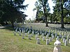 | September 3, 1998 (#98001135) | 833 W. Main St. 38°03′28″N 84°30′40″W / 38.057778°N 84.511111°W / 38.057778; -84.511111 (Lexington National Cemetery) | Lexington | |
| 86 | Lexington Veterans Administration Hospital |  | March 28, 2012 (#12000150) | 2250 Leestown Rd. 38°04′20″N 84°32′24″W / 38.072351°N 84.540088°W / 38.072351; -84.540088 (Lexington Veterans Administration Hospital) | Lexington | |
| 87 | Lexington-Fayette County Government Building Block |  | May 19, 1983 (#83002763) | 200-228 E. Main St. 38°02′41″N 84°29′44″W / 38.044722°N 84.495556°W / 38.044722; -84.495556 (Lexington-Fayette County Government Building Block) | Lexington | |
| 88 | Liggett and Myers Harpring Tobacco Storage Warehouse |  | March 27, 2013 (#13000110) | 1211 Manchester St. 38°03′27″N 84°31′12″W / 38.057500°N 84.520000°W / 38.057500; -84.520000 (Liggett and Myers Harpring Tobacco Storage Warehouse) | Lexington | The Liggett and Myers Harpring Tobacco Storage Warehouse as it originally was - with both water towers. |
| 89 | Liggett and Myers Tobacco Re-handling Facility |  | April 11, 2003 (#03000261) | 200 Bolivar St. 38°02′33″N 84°30′23″W / 38.042500°N 84.506389°W / 38.042500; -84.506389 (Liggett and Myers Tobacco Re-handling Facility) | Lexington | |
| 90 | Mary Todd Lincoln House |  | August 12, 1971 (#71000341) | 574 W. Main St. 38°03′05″N 84°30′10″W / 38.051389°N 84.502778°W / 38.051389; -84.502778 (Mary Todd Lincoln House) | Lexington | |
| 91 | Loudoun House | 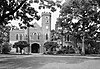 | February 6, 1973 (#73000798) | Corner of Bryan Ave. and Castlewood Dr. 38°03′19″N 84°28′33″W / 38.055278°N 84.475833°W / 38.055278; -84.475833 (Loudoun House) | Lexington | |
| 92 | Mansfield |  | August 19, 1982 (#82002689) | Richmond Rd. 38°01′16″N 84°28′13″W / 38.021111°N 84.470278°W / 38.021111; -84.470278 (Mansfield) | Lexington | |
| 93 | Courtney Mathews House | 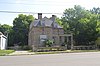 | August 18, 2011 (#11000535) | 547 Breckinridge St. 38°02′53″N 84°28′37″W / 38.048056°N 84.476944°W / 38.048056; -84.476944 (Courtney Mathews House) | Lexington | |
| 94 | Maxwell Place |  | October 29, 1982 (#82000472) | Rose St., University of Kentucky 38°02′10″N 84°30′11″W / 38.036111°N 84.503056°W / 38.036111; -84.503056 (Maxwell Place) | Lexington | |
| 95 | McAdams and Morford Building | 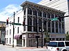 | October 25, 1973 (#73000799) | 200-210 W. Main St. 38°02′50″N 84°29′54″W / 38.047222°N 84.498333°W / 38.047222; -84.498333 (McAdams and Morford Building) | Lexington | |
| 96 | Benjamin McCann House | Upload image | June 3, 1982 (#82002690) | Old Richmond Pike 37°57′51″N 84°25′01″W / 37.964167°N 84.416944°W / 37.964167; -84.416944 (Benjamin McCann House) | Lexington | |
| 97 | Neal McCann House | 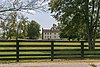 | June 3, 1982 (#82002691) | 5364 Todds Rd. 37°59′37″N 84°21′07″W / 37.993611°N 84.351944°W / 37.993611; -84.351944 (Neal McCann House) | Lexington | |
| 98 | John McCauley House |  | December 4, 1980 (#80001518) | 319 Lexington Ave. 38°02′28″N 84°30′00″W / 38.041111°N 84.500000°W / 38.041111; -84.500000 (John McCauley House) | Lexington | |
| 99 | McConnell Springs |  | January 17, 1976 (#76000874) | Address Restricted | Lexington | |
| 100 | James McConnell House | 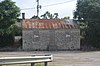 | June 23, 1983 (#83002764) | Old Frankfort Pike 38°03′27″N 84°31′15″W / 38.057500°N 84.520972°W / 38.057500; -84.520972 (James McConnell House) | Lexington | |
| 101 | William McConnell House |  | June 23, 1983 (#83002765) | Forbes Rd. 38°03′33″N 84°31′24″W / 38.059167°N 84.523333°W / 38.059167; -84.523333 (William McConnell House) | Lexington | |
| 102 | McCracken-Wilgus House |  | December 22, 1978 (#78001320) | 327 Wilgus St. 38°02′43″N 84°29′09″W / 38.045278°N 84.485972°W / 38.045278; -84.485972 (McCracken-Wilgus House) | Lexington | |
| 103 | Dr. John McGarvey House |  | May 15, 1974 (#74000864) | 362 S. Mill St. 38°02′44″N 84°30′08″W / 38.045556°N 84.502361°W / 38.045556; -84.502361 (Dr. John McGarvey House) | Lexington | |
| 104 | Charles McPheeters House | 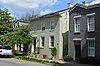 | May 15, 1974 (#74000865) | 352 S. Mill St. 38°02′45″N 84°30′07″W / 38.045833°N 84.502083°W / 38.045833; -84.502083 (Charles McPheeters House) | Lexington | |
| 105 | Mentelle Park |  | November 27, 1985 (#85002973) | Mentelle Pk. 38°02′06″N 84°28′48″W / 38.035°N 84.48°W / 38.035; -84.48 (Mentelle Park) | Lexington | |
| 106 | Middle Reaches of Boone Creek Rural Historic District | Upload image | May 31, 1996 (#96000429) | Roughly bounded by U.S. Route 421, Jones Nursery, Coombs Ferry, Sulpher Well Rds., and U.S. Route 25 37°57′34″N 84°19′17″W / 37.959444°N 84.321389°W / 37.959444; -84.321389 (Middle Reaches of Boone Creek Rural Historic District) | Lexington vicinity | Extends into Clark County |
| 107 | Miller Brothers Building |  | April 2, 1980 (#80001519) | 359-361 W. Main St. 38°02′56″N 84°29′58″W / 38.048889°N 84.499444°W / 38.048889; -84.499444 (Miller Brothers Building) | Lexington | |
| 108 | Moore-Redd-Frazer House |  | October 21, 1976 (#76000875) | Georgetown Pike 38°04′48″N 84°30′47″W / 38.08°N 84.513056°W / 38.08; -84.513056 (Moore-Redd-Frazer House) | Lexington | |
| 109 | John Hunt Morgan Memorial |  | July 17, 1997 (#97000704) | Courthouse Lawn, junction of N. Upper and E. Main St. 38°02′51″N 84°29′55″W / 38.0475°N 84.498611°W / 38.0475; -84.498611 (John Hunt Morgan Memorial) | Lexington | |
| 110 | Will Morton Tavern Stand |  | January 3, 1978 (#78001321) | 137 S. Limestone St. 38°02′44″N 84°29′54″W / 38.045556°N 84.498333°W / 38.045556; -84.498333 (Will Morton Tavern Stand) | Lexington | |
| 111 | William Morton House |  | June 10, 1975 (#75000750) | 518 Limestone St. 38°03′08″N 84°29′14″W / 38.052222°N 84.487222°W / 38.052222; -84.487222 (William Morton House) | Lexington | |
| 112 | Mt. Horeb Archeological District | Upload image | February 12, 1998 (#98000088) | Address Restricted | Lexington | |
| 113 | Mt. Horeb Earthworks, Unit A |  | October 10, 1975 (#75000751) | Address Restricted 38°09′32″N 84°27′56″W / 38.15889°N 84.46556°W / 38.15889; -84.46556 (Mt. Horeb Earthworks, Unit A) | Lexington | |
| 114 | New Zion Historic District | Upload image | December 4, 2008 (#08001118) | 4972 Newtown Pike through 5200 Newtown Pike, and 103-135 New Zion Rd. 38°10′44″N 84°29′11″W / 38.17897°N 84.48637°W / 38.17897; -84.48637 (New Zion Historic District) | Georgetown | African American rural community founded around 1872 on land of two ex slaves. Extends into Scott County . |
| 115 | North Broadway-Short Street Historic District |  | September 15, 1983 (#83000560) | N. Broadway and W. Short St. 38°02′59″N 84°29′55″W / 38.049722°N 84.498611°W / 38.049722; -84.498611 (North Broadway-Short Street Historic District) | Lexington | |
| 116 | North Limestone Commercial District | 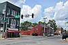 | November 3, 1983 (#83003652) | N. Limestone St. between Church and 3rd Sts. 38°02′52″N 84°29′43″W / 38.047778°N 84.495278°W / 38.047778; -84.495278 (North Limestone Commercial District) | Lexington | |
| 117 | Northeast Residential Historic District |  | October 17, 1985 (#85003151) | Roughly bounded by E. 5th St., Kleiser Ave. and Campsie Pl., E. 4th St., and Humbard Alley 38°02′58″N 84°29′18″W / 38.049444°N 84.488333°W / 38.049444; -84.488333 (Northeast Residential Historic District) | Lexington | |
| 118 | Northside Historic Residential District |  | August 28, 1979 (#79000977) | Roughly bounded by railroad tracks, N. Limestone, W. Short, and Newtown Sts.; also 337-371 N. Limestone, 400-465 N. Limestone, and 356 Morris St. 38°03′17″N 84°29′37″W / 38.054722°N 84.493611°W / 38.054722; -84.493611 (Northside Historic Residential District) | Lexington | Second set of boundaries represents a boundary increase of May 24, 1982 |
| 119 | Odd Fellows Temple |  | February 27, 1980 (#80001520) | 115-119 W. Main St. 38°02′48″N 84°29′50″W / 38.046667°N 84.497222°W / 38.046667; -84.497222 (Odd Fellows Temple) | Lexington | |
| 120 | Old Morrison, Transylvania College |  | October 15, 1966 (#66000358) | W. 3rd St. between Upper St. and Broadway 38°03′05″N 84°29′36″W / 38.051389°N 84.493333°W / 38.051389; -84.493333 (Old Morrison, Transylvania College) | Lexington | |
| 121 | Opera House and Yates Bookshop Building |  | June 11, 1975 (#75000752) | 141 and 145 N. Broadway 38°02′59″N 84°29′57″W / 38.049722°N 84.499028°W / 38.049722; -84.499028 (Opera House and Yates Bookshop Building) | Lexington | |
| 122 | Henry Payne House | Upload image | June 23, 1983 (#83002767) | Off U.S. Route 421 38°06′56″N 84°37′01″W / 38.115556°N 84.616944°W / 38.115556; -84.616944 (Henry Payne House) | Lexington | |
| 123 | Pensacola Park Historic District | 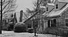 | June 22, 2020 (#100005303) | 109-199 Rosemont Gdn., 105-175 Suburban Ct., 101-224 Lackawanna Rd., 101-166 Wabash Dr., 96-171 Goodrich Ave., 1700, 1800, 1900 blocks of Nicholasville Rd., 101-177 Penmoken Park, 1800 block Pensacola Dr., 1800 block Norfolk Dr. 38°01′02″N 84°31′08″W / 38.0173°N 84.5188°W / 38.0173; -84.5188 (Pensacola Park Historic District) | Lexington | |
| 124 | James E. Pepper Distillery |  | February 11, 2009 (#09000006) | 1200 Manchester St. 38°03′24″N 84°31′12″W / 38.056667°N 84.520000°W / 38.056667; -84.520000 (James E. Pepper Distillery) | Lexington | |
| 125 | Peoples Federal Savings and Loan Association |  | February 12, 2016 (#15000650) | 343 S. Broadway 38°02′49″N 84°30′10″W / 38.046854°N 84.502908°W / 38.046854; -84.502908 (Peoples Federal Savings and Loan Association) | Lexington | no longer extant |
| 126 | James Pettit's Mill | Upload image | June 23, 1983 (#83002768) | Kentucky Route 418 37°55′56″N 84°20′24″W / 37.932222°N 84.34°W / 37.932222; -84.34 (James Pettit's Mill) | Ford | |
| 127 | Pisgah Rural Historic District | Upload image | February 10, 1989 (#88003348) | Area northeast of Versailles roughly bounded by S. Elkhorn Creek, U.S. Route 60, and Big Sink Rd. 38°05′08″N 84°39′40″W / 38.085556°N 84.661111°W / 38.085556; -84.661111 (Pisgah Rural Historic District) | Versailles vicinity | |
| 128 | William Poindexter House |  | May 15, 1974 (#74000867) | 359 S. Mill St. 38°02′45″N 84°30′09″W / 38.045833°N 84.502500°W / 38.045833; -84.502500 (William Poindexter House) | Lexington | |
| 129 | Pope Villa |  | August 30, 2018 (#05000785) | 326 Grosvenor Ave. 38°02′23″N 84°29′44″W / 38.0397°N 84.4956°W / 38.0397; -84.4956 (Pope Villa) | Lexington | |
| 130 | Poplar Grove | Upload image | August 19, 1982 (#82002693) | 2088 Parkers Mill Rd. 38°01′42″N 84°34′27″W / 38.028333°N 84.574167°W / 38.028333; -84.574167 (Poplar Grove) | Lexington | |
| 131 | Pugh Price House | Upload image | September 25, 1979 (#79000978) | 2245 Liberty Rd. 38°01′40″N 84°26′36″W / 38.027778°N 84.443333°W / 38.027778; -84.443333 (Pugh Price House) | Lexington | |
| 132 | Williamson Price House | Upload image | September 25, 1979 (#79000979) | 2497 Liberty Rd. 38°01′14″N 84°26′09″W / 38.020556°N 84.435833°W / 38.020556; -84.435833 (Williamson Price House) | Lexington | |
| 133 | Lewis Ramsey Jr. House | Upload image | March 6, 1991 (#91000121) | 3797 Old Frankfort Pike 38°05′17″N 84°35′36″W / 38.088056°N 84.593333°W / 38.088056; -84.593333 (Lewis Ramsey Jr. House) | Lexington | |
| 134 | Randall Building Bogaert's Jewelry Store |  | September 9, 1982 (#82002694) | 127-129 W. Main St. 38°02′49″N 84°29′50″W / 38.046944°N 84.497222°W / 38.046944; -84.497222 (Randall Building Bogaert's Jewelry Store) | Lexington | |
| 135 | Redd Road Rural Historic District | Upload image | February 28, 1991 (#91000153) | Area largely south and east of the junction of Redd and Frankfort Roads 38°05′30″N 84°37′34″W / 38.091667°N 84.626111°W / 38.091667; -84.626111 (Redd Road Rural Historic District) | Lexington vicinity | |
| 136 | Ridgely House |  | May 7, 1973 (#73000800) | 190 Market St. 38°02′58″N 84°29′45″W / 38.049306°N 84.495833°W / 38.049306; -84.495833 (Ridgely House) | Lexington | |
| 137 | Rockefeller Mound | Upload image | February 12, 1998 (#98000087) | Address Restricted | Lexington | |
| 138 | Joseph Hale Rogers House | Upload image | November 15, 1979 (#79000980) | East of Lexington on Bryan Station Pike 38°04′37″N 84°24′53″W / 38.076944°N 84.414722°W / 38.076944; -84.414722 (Joseph Hale Rogers House) | Lexington | |
| 139 | Rose Hill | 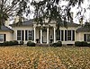 | December 30, 1974 (#74000868) | 461 N. Limestone St. 38°03′08″N 84°29′22″W / 38.052222°N 84.489444°W / 38.052222; -84.489444 (Rose Hill) | Lexington | |
| 140 | Robert Russel House | Upload image | June 23, 1983 (#83002769) | Off Kentucky Route 353 38°08′55″N 84°25′43″W / 38.148611°N 84.428611°W / 38.148611; -84.428611 (Robert Russel House) | Centerville | |
| 141 | Russell School | 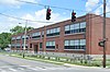 | April 5, 2006 (#06000215) | 201 W. 5th St. 38°03′14″N 84°29′22″W / 38.053889°N 84.489444°W / 38.053889; -84.489444 (Russell School) | Lexington | |
| 142 | Sayre Female Institute |  | August 19, 1982 (#82002695) | 194 N. Limestone St. 38°02′53″N 84°29′39″W / 38.048056°N 84.494167°W / 38.048056; -84.494167 (Sayre Female Institute) | Lexington | |
| 143 | Drs. George W. & Margaret Schwert House | Upload image | May 2, 2024 (#100010248) | 3316 Braemer Drive 37°59′54″N 84°30′15″W / 37.9984°N 84.5043°W / 37.9984; -84.5043 (Drs. George W. & Margaret Schwert House) | Lexington | |
| 144 | Scott and Wilson Houses District |  | December 31, 1974 (#74000869) | 324, 328, 330, 336 S. Mill St. 38°02′46″N 84°30′06″W / 38.046111°N 84.501667°W / 38.046111; -84.501667 (Scott and Wilson Houses District) | Lexington | |
| 145 | Second Presbyterian Church |  | August 11, 1980 (#80001522) | 460 E. Main St. 38°02′24″N 84°29′25″W / 38.040000°N 84.490278°W / 38.040000; -84.490278 (Second Presbyterian Church) | Lexington | |
| 146 | Shady Side | Upload image | November 7, 1976 (#76000876) | 4 miles (6.4 km) east of Lexington on U.S. Route 68 38°05′27″N 84°25′45″W / 38.090833°N 84.429167°W / 38.090833; -84.429167 (Shady Side) | Lexington | |
| 147 | Shelby Family Houses | Upload image | November 17, 1978 (#78001322) | Southeast of Lexington on Richmond Rd., Shelby Lane, and Jacks Creek Pike 37°56′11″N 84°25′24″W / 37.936389°N 84.423333°W / 37.936389; -84.423333 (Shelby Family Houses) | Lexington | |
| 148 | Frederick Shryack House | Upload image | June 23, 1983 (#83002770) | Off Kentucky Route 859 38°03′44″N 84°20′03″W / 38.062222°N 84.334167°W / 38.062222; -84.334167 (Frederick Shryack House) | Clintonville | |
| 149 | Mitchell Baker Smith Company Building | Upload image | August 26, 1980 (#80001523) | 230-232 W. Main St. 38°02′51″N 84°29′55″W / 38.047500°N 84.498611°W / 38.047500; -84.498611 (Mitchell Baker Smith Company Building) | Lexington | |
| 150 | South Hill Historic District | 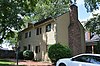 | June 13, 1978 (#78001323) | Roughly bounded by S. Broadway, W. High, S. Limestone, and Pine Sts. 38°02′42″N 84°30′07″W / 38.045°N 84.501944°W / 38.045; -84.501944 (South Hill Historic District) | Lexington | |
| 151 | Southeast Greyhound Line Building | Upload image | January 8, 2014 (#13001048) | 101 W. Loudon St. 38°03′28″N 84°28′54″W / 38.057778°N 84.481667°W / 38.057778; -84.481667 (Southeast Greyhound Line Building) | Lexington | |
| 152 | Southeast Lexington Residential and Commercial District | 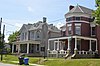 | August 1, 1984 (#84001415) | Roughly bounded by High St., Rose Lane, and Lexington and Woodland Aves. 38°02′18″N 84°29′46″W / 38.038333°N 84.496111°W / 38.038333; -84.496111 (Southeast Lexington Residential and Commercial District) | Lexington | |
| 153 | Southern Railway Passenger Depot |  | August 13, 1987 (#87001364) | 701 S. Broadway 38°02′34″N 84°30′37″W / 38.042778°N 84.510278°W / 38.042778; -84.510278 (Southern Railway Passenger Depot) | Lexington | |
| 154 | Spindletop Farm | Upload image | September 20, 2012 (#12000447) | 3414 Ironworks Pike 38°07′55″N 84°30′18″W / 38.131898°N 84.504917°W / 38.131898; -84.504917 (Spindletop Farm) | Lexington | |
| 155 | Spring Hill Farm | 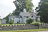 | February 17, 1978 (#78001324) | 1401 Old Frankfort Pike 38°03′30″N 84°31′46″W / 38.058472°N 84.529444°W / 38.058472; -84.529444 (Spring Hill Farm) | Lexington | |
| 156 | Springview Farm |  | August 6, 2012 (#12000448) | 3076 Royster Rd. 38°03′00″N 84°22′49″W / 38.049941°N 84.380141°W / 38.049941; -84.380141 (Springview Farm) | Lexington | |
| 157 | Drewsilla Steele House | Upload image | February 22, 1991 (#91000120) | 3951 Old Frankfort Pike 38°05′22″N 84°35′55″W / 38.089444°N 84.598611°W / 38.089444; -84.598611 (Drewsilla Steele House) | Lexington | |
| 158 | Stony Point | Upload image | August 7, 1979 (#79000981) | 4935 Parkers Mill Rd. 38°01′34″N 84°37′10″W / 38.026111°N 84.619444°W / 38.026111; -84.619444 (Stony Point) | Lexington | |
| 159 | William Lytle Todd House | Upload image | July 17, 1979 (#79000982) | West of Lexington at 3725 Bowman Mill 38°01′19″N 84°35′40″W / 38.021944°N 84.594444°W / 38.021944; -84.594444 (William Lytle Todd House) | Lexington | |
| 160 | Trail's End Camp | Upload image | June 26, 2019 (#100004120) | 8030 Elk Lick Falls Rd. 37°53′59″N 84°21′25″W / 37.8998°N 84.3570°W / 37.8998; -84.3570 (Trail's End Camp) | Lexington vicinity | |
| 161 | Trotter's Warehouse | Upload image | June 18, 1976 (#76000877) | 122-124 S. Mill St. 38°02′51″N 84°29′58″W / 38.0475°N 84.499444°W / 38.0475; -84.499444 (Trotter's Warehouse) | Lexington | Site now occupied by the Lexington Financial Center |
| 162 | United States Post Office and Court House |  | March 18, 1999 (#99000335) | 101 Barr St. 38°02′50″N 84°29′42″W / 38.047222°N 84.495000°W / 38.047222; -84.495000 (United States Post Office and Court House) | Lexington | |
| 163 | Victorian Commercial Block | 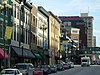 | July 21, 1978 (#78001325) | Bounded by Broadway, Main, Short, and Spring Sts. 38°02′58″N 84°30′00″W / 38.049444°N 84.5°W / 38.049444; -84.5 (Victorian Commercial Block) | Lexington | |
| 164 | Walnut Hill Presbyterian Church | Upload image | May 7, 1973 (#73000801) | East of Lexington off U.S. Route 25 37°58′07″N 84°25′29″W / 37.968611°N 84.424722°W / 37.968611; -84.424722 (Walnut Hill Presbyterian Church) | Lexington | |
| 165 | Dr. Walter Warfield Building |  | August 11, 1980 (#80001524) | 122-124 N. Upper St. and 140-160 W. Short St. 38°02′51″N 84°29′50″W / 38.047500°N 84.497222°W / 38.047500; -84.497222 (Dr. Walter Warfield Building) | Lexington | |
| 166 | Thomas B. Watkins House | 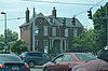 | June 29, 1982 (#82002696) | 1008 S. Broadway 38°02′18″N 84°30′55″W / 38.038333°N 84.515278°W / 38.038333; -84.515278 (Thomas B. Watkins House) | Lexington | |
| 167 | Henry Watt House |  | December 16, 1977 (#77000615) | 703 W. High St. 38°03′01″N 84°30′17″W / 38.050278°N 84.504722°W / 38.050278; -84.504722 (Henry Watt House) | Lexington | |
| 168 | Waveland |  | August 12, 1971 (#71000342) | 5 miles (8.0 km) south of Lexington off U.S. Route 27 37°58′17″N 84°32′14″W / 37.971389°N 84.537222°W / 37.971389; -84.537222 (Waveland) | Lexington | |
| 169 | West Fayette County Rural Historic District | Upload image | February 28, 1991 (#91000154) | Roughly bounded by Rice, Van Meter, Elk Chester, Yarnallton, Leestown, and Viley Rds., and U.S. Route 60 38°04′02″N 84°35′00″W / 38.067222°N 84.583333°W / 38.067222; -84.583333 (West Fayette County Rural Historic District) | Lexington | |
| 170 | West High Street Historic District |  | July 10, 1969 (#69000366) | Northern side of the 100-300 blocks of W. High St. 38°02′49″N 84°30′03″W / 38.046944°N 84.500833°W / 38.046944; -84.500833 (West High Street Historic District) | Lexington | |
| 171 | Western Suburb Historic District |  | June 18, 1976 (#76000878) | Irregular pattern along W. Short St. from Saunter to Kentucky Route 922 38°03′09″N 84°30′09″W / 38.052500°N 84.502500°W / 38.052500; -84.502500 (Western Suburb Historic District) | Lexington | |
| 172 | Wolf Wile Department Store Building |  | July 31, 1996 (#96000795) | 248-250 E. Main St. 38°02′37″N 84°29′40″W / 38.043611°N 84.494444°W / 38.043611; -84.494444 (Wolf Wile Department Store Building) | Lexington | |
| 173 | Woodland |  | August 28, 1975 (#75000753) | 1 mile (1.6 km) east of Lexington on Squires Rd. off U.S. Route 421 37°58′25″N 84°27′37″W / 37.973611°N 84.460278°W / 37.973611; -84.460278 (Woodland) | Lexington | |
| 174 | Woodlands Historic District | 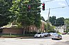 | August 18, 1983 (#83002771) | Roughly bounded by Main and High Sts., Ashland and Woodland Aves. 38°02′06″N 84°29′21″W / 38.035°N 84.489167°W / 38.035; -84.489167 (Woodlands Historic District) | Lexington | |
| 175 | Woodstock | Upload image | May 12, 1975 (#75000754) | Todds Rd. 37°59′23″N 84°21′25″W / 37.989722°N 84.356944°W / 37.989722; -84.356944 (Woodstock) | Lexington | |
| 176 | Woodward Heights Neighborhood Historic District |  | December 1, 1980 (#80001525) | Roughly bounded by High, Merino, and Pine Sts. 38°03′00″N 84°30′25″W / 38.05°N 84.506944°W / 38.05; -84.506944 (Woodward Heights Neighborhood Historic District) | Lexington | |
| 177 | F.W. Woolworth Building |  | September 6, 2002 (#02000924) | 106 Main St. 38°02′47″N 84°29′51″W / 38.046389°N 84.497500°W / 38.046389; -84.497500 (F.W. Woolworth Building) | Lexington | Demolished in October 2004[6] |
| 178 | Allen Worley and Foushee Houses |  | January 20, 1976 (#76000879) | 355, 361, and 367 S. Broadway 38°02′48″N 84°30′13″W / 38.046667°N 84.503611°W / 38.046667; -84.503611 (Allen Worley and Foushee Houses) | Lexington | |
| 179 | Charles Young Park and Community Center | Upload image | February 9, 2016 (#15000413) | 540 E. 3rd St. 38°02′35″N 84°29′03″W / 38.043121°N 84.484132°W / 38.043121; -84.484132 (Charles Young Park and Community Center) | Lexington |
Former listings
| [4] | Name on the Register | Image | Date listed | Date removed | Location | City or town | Description |
|---|---|---|---|---|---|---|---|
| 1 | Augustus Hall House | Upload image | July 12, 1978 (#78001316) | August 19, 1980 | 165 Barr St. | Lexington | Demolished on August 4, 1979[7] |
| 2 | Hathaway Houses | Upload image | November 2, 1978 (#78001317) | December 7, 1981 | 760-766 Pine St. | Lexington | Destroyed by fire May 8, 1980.[8] |
| 3 | West High Street Historic District | Upload image | July 10, 1969 (#69000366) | April 11, 1975 | North side of 100-300 blocks of west High Street | Lexington | All contributing buildings were demolished in 1970. |
| 4 | Milton Sanchez Storage Warehouse | Upload image | October 17, 1980 (#80001521) | May 28, 1982 | Merino St. 38°02′48″N 84°30′12″W / 38.046667°N 84.503333°W / 38.046667; -84.503333 (Milton Sanchez Storage Warehouse) | Lexington | Destroyed by fire on January 25, 1981[9] |
See also
Wikimedia Commons has media related to National Register of Historic Places in Fayette County, Kentucky.
- List of National Historic Landmarks in Kentucky
- National Register of Historic Places listings in Kentucky
References
- ^ The latitude and longitude information provided in this table was derived originally from the National Register Information System, which has been found to be fairly accurate for about 99% of listings. Some locations in this table may have been corrected to current GPS standards.
- ^ National Park Service, United States Department of the Interior, "National Register of Historic Places: Weekly List Actions", retrieved September 5, 2024.
- ^ Bertram, Charles (July 24, 2018). "Confederate statues quietly moved to Lexington Cemetery". kentucky.com. Retrieved 2019-06-20.
- ^ a b Numbers represent an alphabetical ordering by significant words. Various colorings, defined here, differentiate National Historic Landmarks and historic districts from other NRHP buildings, structures, sites or objects.
- ^ The eight-digit number below each date is the number assigned to each location in the National Register Information System database, which can be viewed by clicking the number.
- ^ "F.W. Woolworth in Lexington, Kentucky". Retrieved August 25, 2012.
- ^ "Now you see it..." Lexington Herald-Leader. August 6, 1979. p. A3. Retrieved July 4, 2022 – via Newspapers.com.
- ^ "Fire damages sculptor's boyhood home". Lexington Herald-Leader. May 9, 1980. p. A3. Retrieved July 4, 2022 – via Newspapers.com.
- ^ "Officials sift through burned warehouse". The Courier-Journal. January 27, 1981. p. B3. Retrieved July 4, 2022 – via Newspapers.com.
- v
- t
- e
- List of U.S. National Historic Landmarks by state:
- Alabama
- Alaska
- Arizona
- Arkansas
- California
- Colorado
- Connecticut
- Delaware
- Florida
- Georgia
- Hawaii
- Idaho
- Illinois
- Indiana
- Iowa
- Kansas
- Kentucky
- Louisiana
- Maine
- Maryland
- Massachusetts
- Michigan
- Minnesota
- Mississippi
- Missouri
- Montana
- Nebraska
- Nevada
- New Hampshire
- New Jersey
- New Mexico
- New York
- North Carolina
- North Dakota
- Ohio
- Oklahoma
- Oregon
- Pennsylvania
- Rhode Island
- South Carolina
- South Dakota
- Tennessee
- Texas
- Utah
- Vermont
- Virginia
- Washington
- West Virginia
- Wisconsin
- Wyoming
 National Register of Historic Places portal
 Category


