Halton Lea Gate
 |
| Państwo |  Wielka Brytania Wielka Brytania
|
| Kraj |  Anglia Anglia
|
| Region | North East |
| Hrabstwo | Northumberland |
Położenie na mapie Northumberland |
Położenie na mapie Wielkiej Brytanii |
Położenie na mapie Anglii |
 54°55′11″N 2°32′11″W/54,919722 -2,536389 54°55′11″N 2°32′11″W/54,919722 -2,536389 |
 | Multimedia w Wikimedia Commons | |
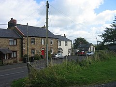
Halton Lea Gate – przysiółek w Anglii, w hrabstwie Northumberland, w civil parish Hartleyburn[1]. W 1901 osada liczyła 310 mieszkańców[2].
Przypisy
- ↑ Keys to the Past. [dostęp 2015-10-30]. [zarchiwizowane z tego adresu (2015-02-19)].
- ↑ Watson Haltwhistle. [dostęp 2015-10-30]. [zarchiwizowane z tego adresu (2016-03-03)].
Miejscowości dystryktu Tynedale (1974–2009)
- Acomb
- Allendale
- Apperley
- Bardon Mill
- Bavington
- Bellingham
- Bingfield
- Birtley
- Blanchland
- Black Hedley
- Broomhaugh
- Broomley
- Bywell
- Chollerton
- Clarewood
- Coalcleugh
- Coanwood
- Corbridge
- Corsenside
- Dilston
- East Apperley
- Edge House
- Fairley
- Falstone
- Featherstone
- Great Bavington
- Great Whittington
- Greenhead
- Greystead
- Hallington
- Halton
- Halton Lea Gate
- Haltwhistle
- Healey
- Hedley on the Hill
- Henshaw
- Hesleywell
- Hexham
- Hindley
- Horsley
- Humshaugh
- Keirsleywell Row
- Kielder
- Kipperlyn
- Kirkhaugh
- Kirkwhelpington
- Knarsdale
- Lee
- Little Bavington
- Little Grottington
- Melkridge
- Merchingley
- Newbrough
- Newlands
- New Ridley
- Newton
- Newton Hall
- Old Ridley
- Otterburn
- Ouston
- Ovingham
- Ovington
- Plenmeller
- Prudhoe
- Riding
- Ridley Mill
- Ridley
- Rochester
- Rowley
- Sandhoe
- Shilford
- Shotley
- Simonburn
- Slaley
- Stocksfield
- Thorngrafton
- Wall
- Warden
- Wark
- Whitfield
- Whitley Chapel
- Whittonstall
- Wylam
|


 54°55′11″N 2°32′11″W/54,919722 -2,536389


 Halton_Lea_Gate