Santo Tomas (La Union)
| Santo Tomas (La Union) | |||
|---|---|---|---|
 | |||
| Land |  Filippinene Filippinene | ||
| Status | kommune | ||
| Postnummer | 2516 | ||
| Retningsnummer | 72 | ||
| Areal | 64 km² | ||
| Befolkning | 40 846[1] (2020) | ||
| Bef.tetthet | 638,22 innb./km² | ||
| Antall husholdninger | 10 392 | ||
| Språk | Ilokano, pangasinansk, tagalog | ||
| Høyde o.h. | 42 meter | ||
| Nettside | www | ||
 Santo Tomas (La Union) 16°17′00″N 120°23′00″Ø | |||
Santo Tomas på Commons | |||
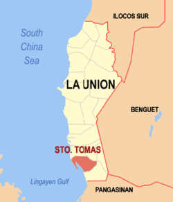
Santo Tomas er en kommune i den filippinske provinsen La Union og ligger ved Lingayenbukten. I 2015 hadde den 39 092 innbyggere.[2]
Barangayer
Santo Tomas er inndelt i 24 barangayer per 30. september 2019.[2]
|
|
Referanser
- ^ «2020 Census of Population and Housing (2020 CPH) Population Counts Declared Official by the President». folketellingen 2020. Filippinenes statistikkbyrå. 7. juli 2021.
- ^ a b Barangays in Santo Tomas (La Union) 2018 Philippine Standard Geographic Code (PSGC)
Eksterne lenker
- Offisielt nettsted

- (en) Santo Tomas, La Union – kategori av bilder, video eller lyd på Commons


