West Somerset
Plaats in Engeland  | |||
|---|---|---|---|
  | |||
| Situering | |||
| Land | Engeland | ||
| County | Somerset | ||
| Regio | South West England | ||
| Coördinaten | 51°6'NB, 3°33'WL | ||
| Algemeen | |||
| Oppervlakte | 725,4079[1] km² | ||
| Inwoners (2001) | 35.075 (48 inw./km²) | ||
| Detailkaart | |||
 | |||
| |||

West Somerset is een plaats in het graafschap Somerset, district Somerset West and Taunton en telt 35.075 inwoners. De oppervlakte bedraagt 727 km².
Van de bevolking is 26,4% ouder dan 65 jaar. De werkloosheid bedraagt 2,9% van de beroepsbevolking (cijfers volkstelling 2001).
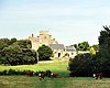
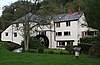
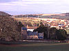
Plaatsen in West Somerset
- Minehead
- Watchet
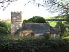
Parishes
| Kerk | Naam | Status | Inwoners[2] | Voormalige local authority | Coördinaten | |
|---|---|---|---|---|---|---|
 | Bicknoller | Civil parish | 394 | Williton Rural District | 51° 8' 60" NB, 3° 16' 12" WL | |
 | Brompton Ralph | Civil parish | 245 | Williton Rural District | 51° 4' 48" NB, 3° 18' 36" WL | |
 | Brompton Regis | Civil parish | 472 | Dulverton Rural District | 51° 4' 12" NB, 3° 29' 24" WL | |
 | Brushford | Civil parish | 565 | Dulverton Rural District | 51° 1' 12" NB, 3° 31' 48" WL | |
 | Carhampton | Civil parish | 1,195 | Williton Rural District | 51° 10' 12" NB, 3° 25' 12" WL | |
 | Clatworthy | Civil parish | 101 | Williton Rural District | 51° 4' 12" NB, 3° 21' 0" WL | |
 | Crowcombe | Civil parish | 589 | Williton Rural District | 51° 7' 12" NB, 3° 13' 48" WL | |
 | Cutcombe | Civil parish | 451 | Williton Rural District | 51° 8' 24" NB, 3° 31' 48" WL | |
 | Dulverton | Town | 1,632 | Dulverton Rural District | 51° 2' 60" NB, 3° 32' 60" WL | |
 | Dunster | Civil parish | 862 | Williton Rural District | 51° 10' 48" NB, 3° 27' 0" WL | |
 | East Quantoxhead | Civil parish | 112 | Williton Rural District | 51° 10' 48" NB, 3° 14' 24" WL | |
 | Elworthy | Civil parish | 103 | Williton Rural District | 51° 6' 36" NB, 3° 18' 36" WL | |
 | Exford | Civil parish | 510 | Dulverton Rural District | 51° 7' 48" NB, 3° 38' 24" WL | |
 | Exmoor | Civil parish | 251 | Dulverton Rural District | 51° 8' 24" NB, 3° 45' 0" WL | |
 | Exton | Civil parish | 229 | Dulverton Rural District | 51° 5' 24" NB, 3° 32' 24" WL | |
 | Holford | Civil parish | 353 | Williton Rural District | 51° 9' 36" NB, 3° 12' 36" WL | |
 | Huish Champflower | Civil parish | 269 | Dulverton Rural District | 51° 3' 36" NB, 3° 21' 36" WL | |
 | Kilve | Civil parish | 397 | Williton Rural District | 51° 10' 48" NB, 3° 13' 12" WL | |
 | Luccombe | Civil parish | 209 | Williton Rural District | 51° 11' 24" NB, 3° 33' 36" WL | |
 | Luxborough | Civil parish | 215 | Williton Rural District | 51° 7' 48" NB, 3° 27' 36" WL | |
 | Minehead | Town | 10,330 | Williton Rural District Minehead Urban District | 51° 12' 0" NB, 3° 28' 12" WL | |
 | Minehead Without | Civil parish | 60 | Williton Rural District | 51° 12' 0" NB, 3° 30' 36" WL | |
 | Monksilver | Civil parish | 107 | Williton Rural District | 51° 7' 48" NB, 3° 19' 48" WL | |
 | Nettlecombe | Civil parish | 240 | Williton Rural District | 51° 7' 48" NB, 3° 21' 0" WL | |
 | Oare | Civil parish | 68 | Williton Rural District | 51° 12' 0" NB, 3° 42' 36" WL | |
 | Old Cleeve | Civil parish | 1,952 | Williton Rural District | 51° 10' 12" NB, 3° 22' 48" WL | |
 | Porlock | Civil parish | 1,377 | Williton Rural District | 51° 12' 36" NB, 3° 36' 0" WL | |
 | Sampford Brett | Civil parish | 277 | Williton Rural District | 51° 9' 36" NB, 3° 18' 36" WL | |
 | Selworthy | Civil parish | 510 | Williton Rural District | 51° 12' 36" NB, 3° 32' 60" WL | |
 | Skilgate | Civil parish | 100 | Dulverton Rural District | 51° 2' 24" NB, 3° 27' 0" WL | |
 | Stogumber | Civil parish | 672 | Williton Rural District | 51° 7' 48" NB, 3° 17' 24" WL | |
 | Stogursey | Civil parish | 1,407 | Williton Rural District | 51° 10' 48" NB, 3° 8' 24" WL | |
 | Stringston | Civil parish | 116 | Williton Rural District | 51° 10' 48" NB, 3° 10' 48" WL | |
 | Timberscombe | Civil parish | 514 | Williton Rural District | 51° 7' 48" NB, 3° 32' 24" WL | |
 | Treborough | Civil parish | 51 | Williton Rural District | 51° 7' 12" NB, 3° 24' 36" WL | |
 | Upton | Civil parish | 165 | Dulverton Rural District | 51° 6' 0" NB, 3° 26' 24" WL | |
 | Watchet | Town | 4,401 | Watchet Urban District | 51° 10' 48" NB, 3° 19' 48" WL | [3] |
 | West Quantoxhead | Civil parish | 506 | Williton Rural District | 51° 10' 12" NB, 3° 16' 12" WL | |
 | Williton | Civil parish | 2,708 | Williton Rural District | 51° 9' 36" NB, 3° 18' 36" WL | |
 | Winsford | Civil parish | 339 | Dulverton Rural District | 51° 6' 0" NB, 3° 34' 12" WL | |
 | Withycombe | Civil parish | 307 | Williton Rural District | 51° 9' 36" NB, 3° 24' 36" WL | |
 | Withypool and Hawkridge | Civil parish | 232 | Dulverton Rural District | 51° 6' 36" NB, 3° 38' 60" WL | |
 | Wootton Courtenay | Civil parish | 305 | Williton Rural District | 51° 10' 48" NB, 3° 31' 12" WL |
Bronnen, noten en/of referenties
- ↑ Office for National Statistics → Download → SAM_for_Administrative_Areas_(2017).zip → SAM_LAD_DEC_2017_UK.xlsx. Gearchiveerd op 9 mei 2019.
- ↑ West Somerset. Parish Population Estimates for 2002. Somerset County Council. Gearchiveerd op 21 november 2009. Geraadpleegd op 15 november 2009.
- ↑ A Vision of Britain Through Time : Watchet Urban District. Great Britain Historical GIS Project 2004/University of Portsmouth. Data © Office of National Statistics, for England and Wales. Gearchiveerd op 23 maart 2012. Geraadpleegd op 8 december 2009.
- Volkstelling 2001, Office for National Statistics


