National Register of Historic Places listings in Hawaii
Map all coordinates using OpenStreetMap
Download coordinates as:
- KML
- GPX (all coordinates)
- GPX (primary coordinates)
- GPX (secondary coordinates)

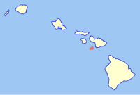
This is a list of properties and historic districts in Hawaii listed on the National Register of Historic Places. More than 370 listings appear on all but one of Hawaii's main islands (Niihau being the exception) and the Northwestern Islands, and in all of its five counties. Included are houses, schools, archeological sites, ships, shipwrecks and various other types of listings. These properties and districts are listed by island, beginning at the northwestern end of the chain.
This National Park Service list is complete through NPS recent listings posted September 13, 2024.[1]
Current listings by island and county


The following are approximate tallies of current listings by island and county. These counts are based on entries in the National Register Information Database as of April 24, 2008[2] and new weekly listings posted since then on the National Register of Historic Places web site, all of which list properties simply by county;[3] they are here divided by island for the sake of easier navigation. There are frequent additions to the listings and occasional delistings, and the counts here are approximate and not official. New entries are added to the official Register on a weekly basis.[4] Also, the counts in this table exclude boundary increase and decrease listings which modify the area covered by an existing property or district and which carry a separate National Register reference number. The number of NRHP listings on each island are documented by tables in each of the individual island lists, and the number of listings in each county is determined by adding the totals of the islands in that county. Kalawao and Maui counties are the sole exception: Kalawao County is a peninsula on Molokai, which is otherwise a part of Maui County.
| Island | # of Sites | |
|---|---|---|
| 1 | Northwestern Hawaiian Islands | 3 |
| 2 | Niihau | 0 |
| 3 | Kauai | 40 |
| 4 | Oahu | 169 |
| 5 | Molokai | 27 |
| 6 | Lanai | 2 |
| 7 | Maui | 39 |
| 8 | Kahoolawe | 1 |
| 9 | Hawaii | 94 |
| TOTAL | 374 | |
| County | # of Sites | |
|---|---|---|
| 1 | Hawaii | 94 |
| 2 | Honolulu | 172 |
| 3 | Kalawao | 2 |
| 4 | Kauai | 40 |
| 5 | Maui | 67 |
| TOTAL | 374 | |
Northwestern Hawaiian Islands

Many small islands, all uninhabited, lie northwest of Kauai. They are included in Honolulu County,[a] despite the vast distance between them and Oahu.[5]
| [6] | Name on the Register | Image | Date listed[7] | Location | Community | Description |
|---|---|---|---|---|---|---|
| 1 | Necker Island Archeological District |  | June 13, 1988 (#88000641) | Address Restricted 23°34′00″N 164°42′00″W / 23.5667°N 164.7°W / 23.5667; -164.7 (Necker Island Archeological District) | Necker Island | Part or all of the island |
| 2 | Nihoa Island Archeological District |  | June 13, 1988 (#88000640) | Address Restricted 23°03′41″N 161°55′32″W / 23.06141°N 161.92543°W / 23.06141; -161.92543 (Nihoa Island Archeological District) | Nihoa Island | Part or all of the island |
| 3 | TWO BROTHERS (New England whaling ship) Shipwreck |  | August 7, 2017 (#100001416) | Address Restricted | French Frigate Shoals |

Kauai is the northernmost of the major islands of Hawaii, and except for Niihau, the westernmost. Together with Niihau, it forms Kauai County.
| [6] | Name on the Register | Image | Date listed[7] | Location | Community | Description |
|---|---|---|---|---|---|---|
| 1 | Bishop National Bank of Hawaii | 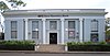 | November 29, 1978 (#78001026) | Hawaii Route 50 21°57′17″N 159°39′59″W / 21.954614°N 159.66648°W / 21.954614; -159.66648 (Bishop National Bank of Hawaii) | Waimea | Now First Hawaiian Bank, 4525 Panako Rd., Waimea |
| 2 | Camp Sloggett |  | August 5, 1993 (#93000773) | Southwest of Hawaii Route 550 22°07′26″N 159°39′02″W / 22.123791°N 159.650499°W / 22.123791; -159.650499 (Camp Sloggett) | Koke'e State Park | Now YWCA Camp |
| 3 | Civilian Conservation Corps Camp in Koke'e State Park |  | December 20, 1996 (#96001504) | Hawaii Route 550 at Kokeʻe State Park Headquarters 22°07′51″N 159°39′33″W / 22.130842°N 159.659174°W / 22.130842; -159.659174 (Civilian Conservation Corps Camp in Koke'e State Park) | Koke'e State Park | |
| 4 | Coco Palms Resort |  | February 16, 2021 (#100006139) | 4-241 Kuhio Highway 22°02′57″N 159°20′09″W / 22.0493°N 159.3359°W / 22.0493; -159.3359 (Coco Palms Resort) | Kapaa | |
| 5 | Cook Landing Site | 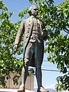 | October 15, 1966 (#66000298) | 2 miles (3.2 km) southwest of Hawaii Route 50 21°57′11″N 159°39′57″W / 21.9531°N 159.6657°W / 21.9531; -159.6657 (Cook Landing Site) | Waimea | |
| 6 | Charles Gay House | Upload image | November 1, 1984 (#84000203) | Gay Rd. 21°58′00″N 159°39′39″W / 21.9666°N 159.6607°W / 21.9666; -159.6607 (Charles Gay House) | Waimea | |
| 7 | Grove Farm |  | June 25, 1974 (#74000722) | On Hawaii Route 58, about 1-mile (1.6 km) southeast of Lihue 21°57′59″N 159°22′06″W / 21.9663°N 159.3682°W / 21.9663; -159.3682 (Grove Farm) | Lihue | Homestead of plantation owner George N. Wilcox, built 1864, converted to museum in 1978 |
| 8 | Grove Farm Company Locomotives |  | January 19, 1979 (#79000761) | Off Hawaii Route 50 21°58′06″N 159°23′50″W / 21.9683°N 159.3972°W / 21.9683; -159.3972 (Grove Farm Company Locomotives) | Puhi | |
| 9 | Gulick-Rowell House | 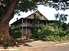 | April 15, 1978 (#78001027) | Missionary Row (now Huakai Rd.) 21°57′41″N 159°40′19″W / 21.9614°N 159.6719°W / 21.9614; -159.6719 (Gulick-Rowell House) | Waimea | Across from Waimea Canyon Middle School, on way to Kauai Veterans Memorial Hospital, first built 1829 by Rev. Peter Johnson Gulick, completed by Rev. George Rowell in 1846 |
| 10 | Haena Archeological Complex | Upload image | November 16, 1984 (#84000257) | Beyond Ha'ena State Park at end of Hawaii Route 560 between high cliffs and rocky shore of Kēʻē Bay 22°13′10″N 159°35′05″W / 22.2195°N 159.5848°W / 22.2195; -159.5848 (Haena Archeological Complex) | Hanalei | Sites: (1) house of high chief Lohiʻau (lover of Hi'iaka); (2) Ke-ahu-a-Laka hālau hula platform; (3) Ka-ulu-a-paʻoa heiau platform[8] |
| 11 | Hanalei Elementary School |  | March 14, 1990 (#90000344) | 5-5161 Kuhio Hwy. 22°12′10″N 159°29′46″W / 22.2027°N 159.4960°W / 22.2027; -159.4960 (Hanalei Elementary School) | Hanalei | Built 1926 |
| 12 | Hanalei Pier |  | September 13, 1979 (#79000757) | Hanalei Bay 22°12′45″N 159°29′52″W / 22.2126°N 159.4979°W / 22.2126; -159.4979 (Hanalei Pier) | Hanalei | |
| 13 | Hanapepe Town Lot No. 18 | 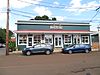 | October 13, 1993 (#93001033) | Hanapepe Rd. west of its junction with Ko Rd. 21°54′41″N 159°35′10″W / 21.9114°N 159.5861°W / 21.9114; -159.5861 (Hanapepe Town Lot No. 18) | Hanapepe | Former pool hall |
| 14 | Haraguchi Rice Mill |  | August 25, 1983 (#83000252) | Ohiki Rd. 22°12′35″N 159°28′36″W / 22.2097°N 159.4767°W / 22.2097; -159.4767 (Haraguchi Rice Mill) | Hanalei | In Hanalei Valley, one of four former rice mills |
| 15 | Kaua'i Belt Road-North Shore section | 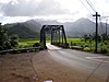 | February 11, 2004 (#03001048) | Hawaii Route 560 22°12′43″N 159°31′40″W / 22.2119°N 159.5278°W / 22.2119; -159.5278 (Kaua'i Belt Road-North Shore section) | Princeville | All or part of Hawaii Route 560 |
| 16 | Kikiaola |  | November 16, 1984 (#84000270) | Menehune Rd., Waimea 21°58′31″N 159°39′35″W / 21.9753°N 159.6597°W / 21.9753; -159.6597 (Kikiaola) | Waimea | A historic ditch purportedly built by the Menehune |
| 17 | Kilauea Plantation Head Bookkeeper's House |  | August 5, 1993 (#93000774) | 2421 Kolo Rd. 22°12′18″N 159°24′36″W / 22.2050°N 159.4100°W / 22.2050; -159.4100 (Kilauea Plantation Head Bookkeeper's House) | Kilauea | |
| 18 | Kilauea Plantation Head Luna's House |  | August 5, 1993 (#93000775) | 2457 Kolo Rd. 22°12′21″N 159°24′38″W / 22.2058°N 159.4106°W / 22.2058; -159.4106 (Kilauea Plantation Head Luna's House) | Kilauea | |
| 19 | Kilauea Plantation Manager's House | Upload image | August 5, 1993 (#93000777) | 4591 Kuawa Rd. 22°12′08″N 159°24′35″W / 22.2023°N 159.4096°W / 22.2023; -159.4096 (Kilauea Plantation Manager's House) | Kilauea | |
| 20 | Kilauea Point Light Station |  | October 18, 1979 (#79000759) | Kilauea Point National Wildlife Refuge 22°13′54″N 159°24′07″W / 22.2316°N 159.4020°W / 22.2316; -159.4020 (Kilauea Point Light Station) | Kilauea | A lighthouse located on a narrow peninsula on Kauai's northern coast |
| 21 | Kilauea School |  | August 18, 1983 (#83000254) | 2440 Kolo Rd. 22°12′22″N 159°24′34″W / 22.2062°N 159.4094°W / 22.2062; -159.4094 (Kilauea School) | Kilauea | Est. 1882 |
| 22 | Kong Lung Store |  | August 5, 1993 (#93000776) | 2484 Keneke Street, on Kilauea Lighthouse Rd., half-mile north of Hawaii Route 56 22°12′44″N 159°24′25″W / 22.212318°N 159.407009°W / 22.212318; -159.407009 (Kong Lung Store) | Kilauea | Originally built to be the Kilauea Plantation store |
| 23 | Kukui Heiau |  | May 18, 1987 (#86002746) | At Alakukui Point on north shore of Wailua Bay (accessible via public right-of-way between the Kauai Sands and Lae Nani Condominium) 22°03′04″N 159°19′46″W / 22.051235°N 159.329433°W / 22.051235; -159.329433 (Kukui Heiau) | Wailua | On state land donated by neighboring condo developers; now landscaped, but retains facing walls and offers good view of Wailua Bay[9] |
| 24 | Lihue Civic Center Historic District | 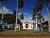 | December 17, 1981 (#81000204) | Off Hawaii Route 50 21°58′30″N 159°22′02″W / 21.975126°N 159.367199°W / 21.975126; -159.367199 (Lihue Civic Center Historic District) | Lihue | |
| 25 | Lihue Hongwanji Mission |  | March 21, 1978 (#78001025) | North of Lihue at Hawaii Route 56 21°59′25″N 159°21′56″W / 21.990303°N 159.365633°W / 21.990303; -159.365633 (Lihue Hongwanji Mission) | Lihue | At 3-3556-A Kuhio Highway, a branch of Honpa Hongwanji Mission of Hawaii |
| 26 | Menehune Fishpond | 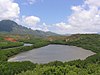 | March 14, 1973 (#73000677) | On the Hulēʻia River south of Lihue (viewable from lookout on south side of Puhi Road) 21°56′55″N 159°22′20″W / 21.948738°N 159.372314°W / 21.948738; -159.372314 (Menehune Fishpond) | Lihue | Also called Alekoko or Niamalu Pond, bounded by wall 900 yards long at large bend in Hulēʻia River[10] |
| 27 | Na Pali Coast Archeological District |  | November 16, 1984 (#84000266) | Address Restricted | Hanalei | |
| 28 | Old Sugar Mill of Koloa |  | October 15, 1966 (#66000296) | Maluhia and Koloa Rds. 21°54′17″N 159°27′57″W / 21.90463°N 159.465816°W / 21.90463; -159.465816 (Old Sugar Mill of Koloa) | Koloa | The mill for Hawaii's first commercially successful sugarcane plantation |
| 29 | Opaekaa Road Bridge |  | March 28, 1983 (#83000253) | ʻŌpaekaʻa Rd. 22°03′32″N 159°22′41″W / 22.058895°N 159.378138°W / 22.058895; -159.378138 (Opaekaa Road Bridge) | Kapaʻa | First built 1890 |
| 30 | Pu'u'opae Bridge |  | May 25, 2005 (#05000536) | Puʻuʻōpae Bridge between Kalama and Kipapa Rds. 22°04′06″N 159°22′23″W / 22.0684°N 159.373096°W / 22.0684; -159.373096 (Pu'u'opae Bridge) | Kapaʻa | One-lane, concrete-encased steel bridge on Puʻuʻōpae Rd. at Kipapa Rd. |
| 31 | Russian Fort |  | October 15, 1966 (#66000299) | On Hawaii Route 50, 200 yards southwest of the bridge over the Waimea River 21°57′07″N 159°39′52″W / 21.951852°N 159.664383°W / 21.951852; -159.664383 (Russian Fort) | Waimea | |
| 32 | Sakuichi and Chieko Matsumoto Residence | Upload image | March 21, 2024 (#100010092) | 2257 Kuai Road 21°52′30″N 159°27′06″W / 21.87496°N 159.4517°W / 21.87496; -159.4517 (Sakuichi and Chieko Matsumoto Residence) | Poipu | |
| 32 | Seto Building |  | September 4, 1979 (#79000758) | 4-1435 Kuhio Highway 22°04′39″N 159°19′01″W / 22.077478°N 159.31698°W / 22.077478; -159.31698 (Seto Building) | Kapaʻa | |
| 33 | Sueoka Market | Upload image | August 16, 2019 (#100004288) | 5392 Koloa Rd. 21°54′15″N 159°27′55″W / 21.9042°N 159.4654°W / 21.9042; -159.4654 (Sueoka Market) | Koloa | |
| 34 | US Post Office-Lihue |  | November 28, 1989 (#89002011) | 4441 Rice St. 21°58′29″N 159°22′08″W / 21.974788°N 159.369004°W / 21.974788; -159.369004 (US Post Office-Lihue) | Lihue | ZIP code 96766 |
| 35 | Wailua Complex of Heiaus |  | October 15, 1966 (#66000297) | At the mouth of the Wailua River in the Lihue District, on the eastern coast of Kauai 22°02′37″N 159°20′09″W / 22.04372°N 159.335959°W / 22.04372; -159.335959 (Wailua Complex of Heiaus) | Wailua | Many ruins of old heiau, ancient Hawaiian temples |
| 36 | Waioli Mission District |  | October 3, 1973 (#73000676) | Off Hawaii Route 560 22°12′04″N 159°30′04″W / 22.201111°N 159.501111°W / 22.201111; -159.501111 (Waioli Mission District) | Hanalei | Established 1834; Mission Hall, built in 1841, is oldest extant church building on the island; was Congregational, now United Church of Christ |
| 37 | Albert Spencer Wilcox Beach House |  | July 30, 1993 (#93000725) | 4943 Weke Rd. 22°12′35″N 159°29′44″W / 22.209651°N 159.495607°W / 22.209651; -159.495607 (Albert Spencer Wilcox Beach House) | Hanalei | |
| 38 | Albert Spencer Wilcox Building | 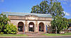 | May 31, 1979 (#79000760) | 4428 Rice St. 21°58′30″N 159°22′06″W / 21.975026°N 159.368257°W / 21.975026; -159.368257 (Albert Spencer Wilcox Building) | Lihue | Designed by Hart Wood in 1922, opened as public library in 1924, converted to Kauaʻi Museum in 1970 |
| 39 | Yamase Building |  | April 12, 1996 (#96000398) | 4493 Moana Rd. 21°57′20″N 159°40′09″W / 21.955532°N 159.669033°W / 21.955532; -159.669033 (Yamase Building) | Waimea |

Oahu is the only major island in Honolulu County. The location of the city of Honolulu, Oahu is the most populous island in the state.

Molokai is the northernmost of the islands of Maui County. Unlike every other island in the state, it is divided between two counties: Kalawao County consists of the island's northern peninsula.
| [6] | Name on the Register | Image | Date listed[7] | Location | Community | Description |
|---|---|---|---|---|---|---|
| 1 | Archeological Site (T-10) 50-60-04-702 | Upload image | November 3, 1982 (#82000152) | Address Restricted | Kawela | |
| 2 | Archeological Site (T-108) 50-60-03-713 | Upload image | November 5, 1982 (#82000163) | Address Restricted | Kawela | |
| 3 | Archeological Site (T-111-116; T-182) 50-60-04-710 | Upload image | November 5, 1982 (#82000164) | Address Restricted | Kawela | |
| 4 | Archeological Site (T-12) 50-60-04-704 | Upload image | November 4, 1982 (#82000153) | Address Restricted | Kawela | |
| 5 | Archeological Site (T-125-6; T-181) 50-60-03-714 | Upload image | November 5, 1982 (#82000165) | Address Restricted | Kawela | |
| 6 | Archeological Site (T-134) 5060-03-718 | Upload image | November 5, 1982 (#82000166) | Address Restricted | Kawela | |
| 7 | Archeological Site (T-135-6) 50-60-03-719 | Upload image | November 5, 1982 (#82000167) | Address Restricted | Kawela | |
| 8 | Archeological Site (T-155, −158) 50-60-03-721 | Upload image | November 5, 1982 (#82000168) | Address Restricted | Kawela | |
| 9 | Archeological Site (T-165-6) 50-60-03-727 | Upload image | November 5, 1982 (#82000169) | Address Restricted | Kawela | |
| 10 | Archeological Site (T-19) 50-60-04-705 | Upload image | November 4, 1982 (#82000154) | Address Restricted | Kawela | |
| 11 | Archeological Site (T-5, T-122, T-178) 50-60-04-142 | Upload image | November 3, 1982 (#82000150) | Address Restricted | Kawela | |
| 12 | Archeological Site (T-57) 50-60-03-720 | Upload image | November 4, 1982 (#82000157) | Address Restricted | Kawela | |
| 13 | Archeological Site (T-6 complex) 50-60-04-700 | Upload image | November 3, 1982 (#82000151) | Address Restricted . | Kawela | |
| 14 | Archeological Site (T-76) 50-60-03-724 | Upload image | November 4, 1982 (#82000158) | Address Restricted | Kawela | |
| 15 | Archeological Site (T-78) 50-60-03-723 | Upload image | November 4, 1982 (#82000170) | Address Restricted | Kawela | |
| 16 | Archeological Site (T-79) 50-60-03-726 | Upload image | November 4, 1982 (#82000159) | Address Restricted | Kawela | |
| 17 | Archeological Site (T-81, −100, −101, −105, −142) 50-60-03-717 | Upload image | November 4, 1982 (#82000160) | Address Restricted | Kawela | |
| 18 | Archeological Site (T-88) 50-60-04-707 | Upload image | November 4, 1982 (#82000161) | Address Restricted | Kawela | |
| 19 | Archeological Site (T-92) 50-60-04-708 | Upload image | November 5, 1982 (#82000162) | Address Restricted | Kawela | |
| 20 | Archeological Site 50-60-04-140 | Upload image | November 3, 1982 (#82000155) | Address Restricted | Kawela | |
| 21 | Archeological Site 50-60-04-144 | Upload image | November 3, 1982 (#82000156) | Address Restricted | Kawela | |
| 22 | Southwest Moloka'i Archeological District | Upload image | October 15, 1986 (#86002811) | Address Restricted | Maunaloa | |
| 23 | Hokukano-Ualapue Complex | Upload image | October 15, 1966 (#66000304) | On Hawaii Route 45 21°03′45″N 156°49′48″W / 21.062528°N 156.83°W / 21.062528; -156.83 (Hokukano-Ualapue Complex) | Ualapue | One of Hawaii's most important archeological sites |
| 24 | Kamehameha V Wall, Archeological Site (T-20 and T-42-3) 50-60-04-706 | Upload image | November 5, 1982 (#82000174) | Address Restricted 21°03′45″N 156°49′48″W / 21.0625°N 156.8300°W / 21.0625; -156.8300 (Kamehameha V Wall, Archeological Site (T-20 and T-42-3) 50-60-04-706) | Kawela | |
| 25 | R. W. Meyer Sugar Mill |  | September 4, 1979 (#79000762) | Hawaii Route 470 21°09′39″N 157°00′32″W / 21.160833°N 157.008889°W / 21.160833; -157.008889 (R. W. Meyer Sugar Mill) | Kalae |
Kalawao County
| [6] | Name on the Register | Image | Date listed[7] | Location | Community | Description |
|---|---|---|---|---|---|---|
| 1 | Kalaupapa National Historical Park |  | January 7, 1976 (#76002145) | Coextensive with the county 21°10′40″N 156°57′36″W / 21.177778°N 156.96°W / 21.177778; -156.96 (Kalaupapa National Historical Park) | Kalaupapa | Park preserving sites of two isolation settlements for Hansen's disease sufferers. |
| 2 | U.S. Coast Guard Molokai Light |  | March 25, 1982 (#82001724) | North of Kalaupapa 21°12′44″N 156°58′21″W / 21.212222°N 156.9725°W / 21.212222; -156.9725 (U.S. Coast Guard Molokai Light) | Kalaupapa | A lighthouse. |

Lanai is the smallest of the populated islands of Maui County, lying between the islands of Maui and Molokai.
| [6] | Name on the Register | Image | Date listed[7] | Location | Community | Description |
|---|---|---|---|---|---|---|
| 1 | Kaunolu Village Site |  | October 15, 1966 (#66000303) | On southwest coast 20°44′05″N 156°57′52″W / 20.734722°N 156.964444°W / 20.734722; -156.964444 (Kaunolu Village Site) | Lanai City | Former fishing village, abandoned in the 1880s, that is the largest surviving ruins of a prehistoric Hawaiian village. |
| 2 | Pu'upehe Platform (50La19) |  | October 6, 1986 (#86002745) | Between Mānele Bay and Hulopoʻe Bay 20°44′02″N 156°53′24″W / 20.733889°N 156.89°W / 20.733889; -156.89 (Pu'upehe Platform (50La19)) | Lanai City | Also known as Sweetheart Rock |

Maui is the largest and the easternmost island of Maui County.
| [6] | Name on the Register | Image | Date listed[7] | Location | Community | Description |
|---|---|---|---|---|---|---|
| 1 | Fred C. Baldwin Memorial Home |  | December 1, 2011 (#11000437) | 1813 Baldwin Ave. 20°53′12″N 156°20′43″W / 20.886667°N 156.345278°W / 20.886667; -156.345278 (Fred C. Baldwin Memorial Home) | Makawao | Built in 1910 by Emily Alexander Baldwin and Henry Perrine Baldwin to provide housing for the elderly. Named for their son Fred Baldwin (1881–1905).[11] Originally designed by H.L. Kerr; restored in 2011 by Xorin Balbes to operate as a lodging and educational facility named Lumeria Maui.[12] |
| 2 | Henry Perrine Baldwin High School | 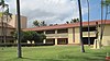 | June 30, 2000 (#00000667) | Junction of Lower Main St. and Kaahumanu Ave. 20°53′45″N 156°29′38″W / 20.895833°N 156.493889°W / 20.895833; -156.493889 (Henry Perrine Baldwin High School) | Wailuku | |
| 3 | Bank of Hawaii—Haiku Branch |  | December 4, 2000 (#00001284) | 771 Haiku Rd. 20°54′53″N 156°19′22″W / 20.914722°N 156.322778°W / 20.914722; -156.322778 (Bank of Hawaii—Haiku Branch) | Haʻikū | Built 1931 to serve as bank and post office for bustling Haʻikū; restored in 1998; now used as a commercial property.[13] |
| 4 | Chee Kung Tong Society Building |  | November 15, 1982 (#82000171) | 2151 Vineyard St. 20°53′36″N 156°30′29″W / 20.893333°N 156.508056°W / 20.893333; -156.508056 (Chee Kung Tong Society Building) | Wailuku | Part of the Chinese Tong Houses of Maui Island TR #82000173. Collapsed in 1996; only gate and foundation remain. |
| 5 | Crater Historic District |  | November 1, 1974 (#74000289) | Address Restricted | Kahului | |
| 6 | Frank and Theresa Gomes House | 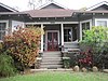 | June 15, 2001 (#01000616) | 32 Pakani Place 20°50′58″N 156°19′03″W / 20.849444°N 156.3175°W / 20.849444; -156.3175 (Frank and Theresa Gomes House) | Makawao | |
| 7 | Haiku Mill | Upload image | February 6, 1986 (#86000189) | Haiku Rd. 20°55′49″N 156°19′58″W / 20.930278°N 156.332778°W / 20.930278; -156.332778 (Haiku Mill) | Haʻikū | |
| 8 | Hale Paʻi |  | May 13, 1976 (#76000662) | Lahainaluna High School 20°53′40″N 156°39′45″W / 20.894444°N 156.6625°W / 20.894444; -156.6625 (Hale Paʻi) | Lahaina | |
| 9 | Halekii-Pihana Heiau | 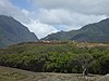 | November 25, 1985 (#85002972) | Hea Pl. off Kuhio Pl. from Waiehu Beach Rd. 20°54′30″N 156°29′42″W / 20.908333°N 156.495°W / 20.908333; -156.495 (Halekii-Pihana Heiau) | Wailuku | |
| 10 | Hana Belt Road |  | June 15, 2001 (#01000615) | Hana Highway (Hawaii Route 360) and Pi'ilani Highway (Hawaii Route 31) 20°53′52″N 156°13′20″W / 20.897778°N 156.222222°W / 20.897778; -156.222222 (Hana Belt Road) | Makawao | |
| 11 | Hana District Police Station and Courthouse |  | August 27, 1991 (#91001086) | Uakea Rd. 20°45′44″N 155°59′21″W / 20.762222°N 155.989167°W / 20.762222; -155.989167 (Hana District Police Station and Courthouse) | Hana | |
| 12 | Hardy House |  | November 8, 1984 (#84002640) | 808 Makawao Ave. 20°51′06″N 156°19′25″W / 20.851667°N 156.323611°W / 20.851667; -156.323611 (Hardy House) | Makawao | Built in 1897 for Makawao School principal Frederick Hardy (d. 1920) & wife Lillian, who sold the house & 20-acre (81,000 m2) lot in 1920. Ernest and Alene Rezents bought the house in 1961 and restored what is now locally known as the Rezents House.[14] |
| 13 | Holy Ghost Catholic Church |  | August 18, 1983 (#83000255) | 4300 Lower Kula Rd. 20°46′04″N 156°20′22″W / 20.767778°N 156.339444°W / 20.767778; -156.339444 (Holy Ghost Catholic Church) | Kula | |
| 14 | Honokalani Village | Upload image | November 25, 1985 (#85003333) | Address Restricted | Hana | |
| 15 | Iao Theater |  | February 9, 1995 (#94001622) | 68 N. Market St. 20°53′37″N 156°30′17″W / 20.893611°N 156.504722°W / 20.893611; -156.504722 (Iao Theater) | Wailuku | |
| 16 | Ka'ahumanu Avenue-Naniloa Drive Overpass |  | November 19, 2008 (#08001065) | Naniloa Dr. at Kaahumanu Ave. 20°53′19″N 156°29′46″W / 20.88871°N 156.49602°W / 20.88871; -156.49602 (Ka'ahumanu Avenue-Naniloa Drive Overpass) | Wailuku | |
| 17 | Ka'ahumanu Church |  | May 12, 1975 (#75000622) | S. High St. 20°53′49″N 156°30′01″W / 20.896944°N 156.500278°W / 20.896944; -156.500278 (Ka'ahumanu Church) | Wailuku | Est. 1876 |
| 18 | Kahului Railroad Administration Building |  | May 17, 2016 (#16000274) | 101 E. Kaahumanu Ave. 20°53′34″N 156°27′52″W / 20.892678°N 156.464474°W / 20.892678; -156.464474 (Kahului Railroad Administration Building) | Kahului | |
| 19 | Kalepolepo Fishpond |  | December 30, 1996 (#96001503) | S. Kihei Rd., south of its junction with Hawaii Route 31 in Kalepolepo County Park 20°46′00″N 156°27′45″W / 20.766667°N 156.4625°W / 20.766667; -156.4625 (Kalepolepo Fishpond) | Kihei | |
| 20 | William K. Kaluakini House | Upload image | July 3, 2013 (#13000458) | 450 Front St. 20°52′00″N 156°40′26″W / 20.866688°N 156.673843°W / 20.866688; -156.673843 (William K. Kaluakini House) | Lahaina | |
| 21 | Kaupo School | Upload image | June 30, 2000 (#00000662) | Government Rd. 20°38′13″N 156°07′21″W / 20.636866°N 156.122592°W / 20.636866; -156.122592 (Kaupo School) | Kaupo | |
| 22 | Keanae School |  | June 30, 2000 (#00000665) | Hana Highway 20°51′21″N 156°08′29″W / 20.855833°N 156.141389°W / 20.855833; -156.141389 (Keanae School) | Keanae | |
| 23 | Ket Hing Society Building |  | November 15, 1982 (#82000172) | Cross Rd. 20°42′35″N 156°21′11″W / 20.709722°N 156.353056°W / 20.709722; -156.353056 (Ket Hing Society Building) | Kula | Part of the Chinese Tong Houses of Maui Island TR #82000173. |
| 24 | King Kamehameha III's Royal Residential Complex |  | May 9, 1997 (#97000408) | Junction of Front and Shaw Sts., Malu'ulu o Lele and Kamehameha Iki Parks 20°52′24″N 156°40′39″W / 20.873333°N 156.6775°W / 20.873333; -156.6775 (King Kamehameha III's Royal Residential Complex) | Lahaina | |
| 25 | Lahaina Historic District |  | October 15, 1966 (#66000302) | Western side of Maui on Hawaii Route 30 20°52′14″N 156°41′03″W / 20.870556°N 156.684167°W / 20.870556; -156.684167 (Lahaina Historic District) | Lahaina | |
| 26 | Loaloa Heiau | 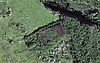 | October 15, 1966 (#66000301) | Southeastern coast of Maui, on Hawaii Route 31, about 0.25 miles (0.40 km) north of Kaupo 20°38′41″N 156°07′26″W / 20.644722°N 156.123889°W / 20.644722; -156.123889 (Loaloa Heiau) | Kaupo | |
| 27 | Maʻalaea General Store |  | September 30, 2013 (#13000795) | 132 Maʻalaea Road 20°47′32″N 156°30′42″W / 20.792262°N 156.511624°W / 20.792262; -156.511624 (Maʻalaea General Store) | Wailuku vicinity | Built in 1910 and accurately restored. The store and the Shinto Shrine next door are all that remains of the Japanese fishing village there prior to World War II.[15] |
| 28 | Makawao Union Church |  | December 17, 1985 (#85003227) | 1445 Baldwin Ave. 20°53′32″N 156°21′03″W / 20.892222°N 156.350833°W / 20.892222; -156.350833 (Makawao Union Church) | Paia | 1916 stone church designed by C. W. Dickey |
| 29 | Maui Jinsha Mission |  | November 21, 1978 (#78001028) | 472 Lipo St. 20°54′29″N 156°29′16″W / 20.908056°N 156.487778°W / 20.908056; -156.487778 (Maui Jinsha Mission) | Wailuku | est. 1915, architect Ichitaro Takata |
| 30 | Old Bailey House |  | March 20, 1973 (#73000678) | Iao Valley Rd. 20°53′27″N 156°30′37″W / 20.890833°N 156.510278°W / 20.890833; -156.510278 (Old Bailey House) | Wailuku | |
| 31 | Paia School |  | August 22, 2000 (#00000664) | 955 Baldwin Ave. 20°54′11″N 156°21′24″W / 20.903056°N 156.356667°W / 20.903056; -156.356667 (Paia School) | Pāʻia | Founded in 1881 as Maui's first all English-speaking school. First principal William Cross refused to learn Hawaiian. 1909 building burned down in 1963. Current main building dates from 1926. Became site of Maui's first public school Hawaiian-immersion program in 1988.[16] |
| 32 | Piilanihale Heiau |  | October 15, 1966 (#66000300) | 4 miles (6.4 km) north of Hana, at the mouth of Honomāʻele Gulch near Kalahu Point 20°47′57″N 156°02′18″W / 20.799167°N 156.038333°W / 20.799167; -156.038333 (Piilanihale Heiau) | Hana | Within Kahanu Garden |
| 33 | Puunene School |  | August 22, 2000 (#00000663) | East Camp 5 Rd. off Old Puunene Ave. 20°51′44″N 156°26′56″W / 20.862222°N 156.448889°W / 20.862222; -156.448889 (Puunene School) | Puʻnēnē | 1922 school building near sugar mill |
| 34 | Wai'ale Drive Bridge |  | October 30, 1998 (#98001287) | Ka'ahumanu Ave., 0.1 miles (0.16 km) east of Kinipopo St. 20°53′39″N 156°30′06″W / 20.894167°N 156.501667°W / 20.894167; -156.501667 (Wai'ale Drive Bridge) | Wailuku | |
| 35 | Waihee Church | 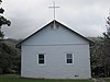 | April 21, 1994 (#94000384) | Kahekili Highway 20°56′06″N 156°30′54″W / 20.935°N 156.515°W / 20.935; -156.515 (Waihee Church) | Waihee | est. 1828 |
| 36 | Wailuku Civic Center Historic District |  | August 20, 1986 (#86001624) | S. High St. between Wells and Kaohu Sts. 20°53′25″N 156°30′26″W / 20.890278°N 156.507222°W / 20.890278; -156.507222 (Wailuku Civic Center Historic District) | Wailuku | Contributing properties: Old Courthouse (1907, Kerr), Old Police Station (1925, D'Esmond), Wailuku Library (1928, Dickey), Territorial Office Building (1931, Dickey) |
| 37 | Wailuku School |  | June 30, 2000 (#00000666) | 355 S. High St. 20°53′17″N 156°30′29″W / 20.888056°N 156.508056°W / 20.888056; -156.508056 (Wailuku School) | Wailuku | est. 1904,[17] architect C. W. Dickey |
| 38 | Wananalua Congregational Church |  | November 23, 1988 (#88002533) | Hana Highway and Haouli St. 20°45′07″N 155°59′12″W / 20.752002°N 155.986579°W / 20.752002; -155.986579 (Wananalua Congregational Church) | Hana | |
| 39 | Wo Hing Society Building | 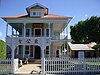 | November 15, 1982 (#82000173) | 848 Front St. 20°52′52″N 156°40′59″W / 20.881111°N 156.683056°W / 20.881111; -156.683056 (Wo Hing Society Building) | Lahaina | In the Lahaina Historic District; Part of the Chinese Tong Houses of Maui Island TR #82000173. |
Kahoolawe is the smallest and the southernmost island of Maui County. Alone among the state's major islands, it is uninhabited.
| [6] | Name on the Register | Image | Date listed[7] | Location | Community | Description |
|---|---|---|---|---|---|---|
| 1 | Kahoʻolawe Island Archeological District |  | March 18, 1981 (#81000205) | Kahoolawe 20°33′N 156°36′W / 20.55°N 156.6°W / 20.55; -156.6 (Kahoʻolawe Island Archeological District) | Kahoʻolawe | The district includes the entire island, which contains over 500 individual archeological sites[18] |
Island of Hawaii


The government of the island of Hawaii is Hawaii County, the only county that covers exactly one island, the largest in area in the state. There are 67 properties and districts on the island, including 10 historic districts, six National Historic Landmarks, and one which is a National Historic Landmark District.
Notes
- ^ Midway Atoll is an exception to the inclusion of the Northwestern Hawaiian Islands in Honolulu County. Although part of the Hawaiian archipelago geographically, Midway is under the plenary jurisdiction of the federal government, and is not part of the state of Hawaii. See National Register of Historic Places listings in the United States Minor Outlying Islands for National Register listings on Midway.
References
- ^ National Park Service, United States Department of the Interior, "National Register of Historic Places: Weekly List Actions", retrieved September 13, 2024.
- ^ "National Register Information System". National Register of Historic Places. National Park Service. April 24, 2008.
- ^ "National Register of Historic Places: Weekly List Actions". National Park Service. Archived from the original on January 26, 2011. Retrieved January 2, 2009.
- ^ Weekly List Actions, National Register of Historic Places website
- ^ Detailed maps of Hawaii, United States Census Bureau, 2000. Accessed 2009-01-31.
- ^ a b c d e f g Numbers represent an alphabetical ordering by significant words. Various colorings, defined here, differentiate National Historic Landmarks and historic districts from other NRHP buildings, structures, sites or objects.
- ^ a b c d e f g The eight-digit number below each date is the number assigned to each location in the National Register Information System database, which can be viewed by clicking the number.
- ^ Kirch, Patrick Vinton (1996). "Ke-ahu-a-Laka Hālau Hula and Ka-ulu-a-paʻoa Heiau at Hāʻena". Legacy of the Landscape: An Illustrated Guide to Hawaiian Archaeological Sites. Honolulu: University of Hawaii Press. pp. 20–21. ISBN 0-8248-1739-7.
- ^ Kirch, Patrick Vinton (1996). "Heiau Complex at Wailua". Legacy of the Landscape: An Illustrated Guide to Hawaiian Archaeological Sites. Honolulu: University of Hawaii Press. p. 18. ISBN 0-8248-1739-7.
- ^ Kirch, Patrick Vinton (1996). "Menehune Fishpond". Legacy of the Landscape: An Illustrated Guide to Hawaiian Archaeological Sites. Honolulu: University of Hawaii Press. p. 23. ISBN 0-8248-1739-7.
- ^ "Fred Baldwin Memorial Foundation". Founders & History. Fred Baldwin Memorial Foundation. Retrieved November 16, 2013.
- ^ "Baldwin Memorial Home to be Preserved Through Perpetual Preservation Easement Donated to Historic Hawaii". Advocacy. Historic Hawaii Foundation. Archived from the original on February 22, 2012. Retrieved November 17, 2013.
- ^ Engledow, Jill (2001). Exploring Historic Upcountry (Small Town Series Maui). Watermark Publishing. p. 50. ISBN 0-9705787-5-X.
- ^ Engledow, Jill (2001). Exploring Historic Upcountry (Small Town Series Maui). Watermark Publishing. p. 74. ISBN 0-9705787-5-X.
- ^ "Ma'alaea General Store & Cafe". About Ma‘alaea. Archived from the original on December 13, 2013. Retrieved November 16, 2013.
- ^ Engledow, Jill (2001). Exploring Historic Upcountry (Small Town Series Maui). Watermark Publishing. p. 38. ISBN 0-9705787-5-X.
- ^ Christie Wilson (April 21, 2004). "Wailuku school peeks into past". Honolulu Advertiser. Retrieved March 24, 2010.
- ^ Barrera, William, Jr. Kaho'olaw Archaeology: An Overview Hawaiian Archaeology, Vol. 1(1). Accessed 2009-02-09.
External links
Wikimedia Commons has media related to National Register of Historic Places in Hawaii.
- Historic Hawaii Foundation
- Inventory of Historic Properties on official Hawaii State web site
- v
- t
- e
State of Hawaii
Honolulu (capital)
- Outline
- Constitution
- Delegations
- Discovery and settlement
- Earthquakes
- Geography
- Government
- Hawaiianization
- History
- Hurricanes
- Islands
- Kūʻē Petitions
- Music
- Native Hawaiians
- ʻŌlelo Hawaiʻi (Hawaiian Language)
- Parks
- Pearl Harbor National Memorial
- USS Arizona
- People
- State symbols
- Tourism
- Transportation
- Unification
Islands
 Hawaii portal
| |
|---|---|
| Topics | |
| Lists by state |
|
| Lists by insular areas | |
| Lists by associated state | |
| Other areas | |
| Related | |
| |


