National Register of Historic Places listings in Hart County, Georgia
This is a list of properties and districts in Hart County, Georgia that are listed on the National Register of Historic Places (NRHP).
Map all coordinates using OpenStreetMap
Download coordinates as:
- KML
- GPX (all coordinates)
- GPX (primary coordinates)
- GPX (secondary coordinates)
This National Park Service list is complete through NPS recent listings posted September 5, 2024.[1]
- v
- t
- e
Properties on the National Register of Historic Places in Georgia by county
- Appling
- Atkinson
- Bacon
- Baker
- Baldwin
- Banks
- Barrow
- Bartow
- Ben Hill
- Berrien
- Bibb
- Bleckley
- Brantley
- Brooks
- Bryan
- Bulloch
- Burke
- Butts
- Calhoun
- Camden
- Candler
- Carroll
- Catoosa
- Charlton
- Chatham
- Chattahoochee
- Chattooga
- Cherokee
- Clarke
- Clay
- Clayton
- Clinch
- Cobb
- Coffee
- Colquitt
- Columbia
- Cook
- Coweta
- Crawford
- Crisp
- Dade
- Dawson
- Decatur
- DeKalb
- Dodge
- Dooly
- Dougherty
- Douglas
- Early
- Echols
- Effingham
- Elbert
- Emanuel
- Evans
- Fannin
- Fayette
- Floyd
- Forsyth
- Franklin
- Fulton
- Gilmer
- Glascock
- Glynn
- Gordon
- Grady
- Greene
- Gwinnett
- Habersham
- Hall
- Hancock
- Haralson
- Harris
- Hart
- Heard
- Henry
- Houston
- Irwin
- Jackson
- Jasper
- Jeff Davis
- Jefferson
- Jenkins
- Johnson
- Jones
- Lamar
- Lanier
- Laurens
- Lee
- Liberty
- Lincoln
- Long
- Lowndes
- Lumpkin
- Macon
- Madison
- Marion
- McDuffie
- McIntosh
- Meriwether
- Miller
- Mitchell
- Monroe
- Montgomery
- Morgan
- Murray
- Muscogee
- Newton
- Oconee
- Oglethorpe
- Paulding
- Peach
- Pickens
- Pierce
- Pike
- Polk
- Pulaski
- Putnam
- Quitman
- Rabun
- Randolph
- Richmond
- Rockdale
- Schley
- Screven
- Seminole
- Spalding
- Stephens
- Stewart
- Sumter
- Talbot
- Taliaferro
- Tattnall
- Taylor
- Telfair
- Terrell
- Thomas
- Tift
- Toombs
- Towns
- Treutlen
- Troup
- Turner
- Twiggs
- Union
- Upson
- Walker
- Walton
- Ware
- Warren
- Washington
- Wayne
- Webster
- Wheeler
- White
- Whitfield
- Wilcox
- Wilkes
- Wilkinson
- Worth

Current listings
| [2] | Name on the Register | Image | Date listed[3] | Location | City or town | Description |
|---|---|---|---|---|---|---|
| 1 | Adams-Matheson House |  | September 11, 1986 (#86002003) | 116 Athens St. 34°21′06″N 82°56′27″W / 34.351667°N 82.940833°W / 34.351667; -82.940833 (Adams-Matheson House) | Hartwell | |
| 2 | Archibald Mewborn House | Upload image | January 9, 1997 (#96001556) | Approximately 1 mi. E of GA 172, 7 mi. S of Hartwell 34°14′43″N 82°57′26″W / 34.245278°N 82.957222°W / 34.245278; -82.957222 (Archibald Mewborn House) | Hartwell | |
| 3 | Benson Street-Forest Avenue Residential Historic District |  | September 11, 1986 (#86002004) | Roughly along Benson St. from Forest Ave. to Adams St. and along Forest Ave. from Railroad St. to Garrison Rd. 34°20′52″N 82°55′52″W / 34.347778°N 82.931111°W / 34.347778; -82.931111 (Benson Street-Forest Avenue Residential Historic District) | Hartwell | |
| 4 | Allie M. Best House |  | September 11, 1986 (#86002005) | 122 Athens St. 34°21′02″N 82°56′30″W / 34.350556°N 82.941667°W / 34.350556; -82.941667 (Allie M. Best House) | Hartwell | |
| 5 | Bowersville Historic District | 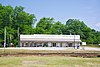 | September 5, 1985 (#85001975) | E. and W. Main St. 34°22′22″N 83°05′00″W / 34.372778°N 83.083333°W / 34.372778; -83.083333 (Bowersville Historic District) | Bowersville | |
| 6 | Chandler-Linder House |  | September 11, 1986 (#86002006) | Johnson St. 34°21′19″N 82°56′07″W / 34.355278°N 82.935278°W / 34.355278; -82.935278 (Chandler-Linder House) | Hartwell | |
| 7 | H. E. Fortson House |  | September 11, 1986 (#86002007) | 221 Richardson St. 34°21′30″N 82°55′42″W / 34.358333°N 82.928333°W / 34.358333; -82.928333 (H. E. Fortson House) | Hartwell | |
| 8 | Franklin Light and Power Company Steam Generating Station | Upload image | September 11, 1986 (#86002009) | Leard St. at RR track 34°21′20″N 82°56′46″W / 34.355556°N 82.946111°W / 34.355556; -82.946111 (Franklin Light and Power Company Steam Generating Station) | Hartwell | |
| 9 | Franklin Street-College Avenue Residential Historic District |  | September 11, 1986 (#86002011) | Roughly bounded by Johnson, Maple, Franklin and First, and Carter Sts. 34°21′09″N 82°55′42″W / 34.3525°N 82.928333°W / 34.3525; -82.928333 (Franklin Street-College Avenue Residential Historic District) | Hartwell | |
| 10 | Gulley-Gurley Farm | Upload image | April 17, 1997 (#97000334) | 1389 Lou Gurley Road 34°23′54″N 83°02′11″W / 34.398333°N 83.036389°W / 34.398333; -83.036389 (Gulley-Gurley Farm) | Bowersville | |
| 11 | Gulley-Vickery-Blackwell House | Upload image | September 11, 1986 (#86002014) | 115 Franklin St. 34°21′13″N 82°55′56″W / 34.353611°N 82.932222°W / 34.353611; -82.932222 (Gulley-Vickery-Blackwell House) | Hartwell | Home does not seem to exist any more. |
| 12 | Hart County Jail |  | September 13, 1985 (#85002085) | Johnson St. 34°21′17″N 82°56′00″W / 34.354722°N 82.933333°W / 34.354722; -82.933333 (Hart County Jail) | Hartwell | |
| 13 | Hartwell City School |  | September 11, 1986 (#86002016) | College Ave. 34°20′58″N 82°55′44″W / 34.349444°N 82.928889°W / 34.349444; -82.928889 (Hartwell City School) | Hartwell | |
| 14 | Hartwell Commercial Historic District |  | September 11, 1986 (#86002019) | Roughly bounded by Franklin St., Forest Ave., Railroad St., and Jackson and Carolina Sts. 34°21′07″N 82°56′00″W / 34.351944°N 82.933333°W / 34.351944; -82.933333 (Hartwell Commercial Historic District) | Hartwell | |
| 15 | Hartwell Methodist Episcopal Church, South |  | September 11, 1986 (#86002021) | Howell St. 34°21′10″N 82°56′09″W / 34.352778°N 82.935833°W / 34.352778; -82.935833 (Hartwell Methodist Episcopal Church, South) | Hartwell | |
| 16 | Horton-Vickery House |  | September 11, 1986 (#86002024) | 101 Vickery St. 34°21′28″N 82°55′51″W / 34.357778°N 82.930833°W / 34.357778; -82.930833 (Horton-Vickery House) | Hartwell | |
| 17 | Pearl J. Jones House |  | September 11, 1986 (#86002027) | 401 Athens St. 34°20′43″N 82°56′37″W / 34.345278°N 82.943611°W / 34.345278; -82.943611 (Pearl J. Jones House) | Hartwell | |
| 18 | Kendrick-Matheson House |  | September 11, 1986 (#86002029) | 212 Athens St. 34°20′55″N 82°56′32″W / 34.348611°N 82.942222°W / 34.348611; -82.942222 (Kendrick-Matheson House) | Hartwell | |
| 19 | Charles I. Kidd House |  | September 11, 1986 (#86002032) | 304 W. Howell St. 34°21′12″N 82°56′11″W / 34.353333°N 82.936389°W / 34.353333; -82.936389 (Charles I. Kidd House) | Hartwell | |
| 20 | Roscoe Conklin Linder House |  | September 11, 1986 (#86002033) | 118 Athens St. 34°21′05″N 82°56′28″W / 34.351389°N 82.941111°W / 34.351389; -82.941111 (Roscoe Conklin Linder House) | Hartwell | |
| 21 | McCurry-Kidd House |  | September 11, 1986 (#86002035) | 602 W. Howell St. 34°21′17″N 82°56′22″W / 34.354618°N 82.939431°W / 34.354618; -82.939431 (McCurry-Kidd House) | Hartwell | Two-story brick Georgian Revival-style house from c.1920, believed to be the only Georgian Revival house in Hartwell. |
| 22 | McMullan-Vickery Farm |  | September 11, 1986 (#86002037) | 602 Forest Ave. 34°21′39″N 82°55′45″W / 34.360833°N 82.929167°W / 34.360833; -82.929167 (McMullan-Vickery Farm) | Hartwell | |
| 23 | Dr. Owen Meredith House |  | September 11, 1986 (#86002040) | 605 Benson St. 34°20′42″N 82°55′32″W / 34.345°N 82.925556°W / 34.345; -82.925556 (Dr. Owen Meredith House) | Hartwell | |
| 24 | Jackson Morrison House |  | September 11, 1986 (#86002046) | 439 Rome St. 34°21′44″N 82°55′29″W / 34.362222°N 82.924722°W / 34.362222; -82.924722 (Jackson Morrison House) | Hartwell | |
| 25 | Patterson-Turner Homeplace | Upload image | July 26, 1990 (#90001126) | Smith-McGee Bridge Rd. 34°21′16″N 82°54′27″W / 34.354444°N 82.9075°W / 34.354444; -82.9075 (Patterson-Turner Homeplace) | Hartwell | |
| 26 | Pure Oil Service Station |  | September 11, 1986 (#86002047) | Howell St. at Jackson St. 34°21′10″N 82°56′03″W / 34.352778°N 82.934167°W / 34.352778; -82.934167 (Pure Oil Service Station) | Hartwell | |
| 27 | Emory Edward Satterfield House |  | September 11, 1986 (#86002049) | 504 W. Howell St. 34°21′15″N 82°56′19″W / 34.354167°N 82.938611°W / 34.354167; -82.938611 (Emory Edward Satterfield House) | Hartwell | |
| 28 | Meyer Saul House | Upload image | September 11, 1986 (#86002043) | 304 W. Johnson St. 34°21′19″N 82°56′09″W / 34.355278°N 82.935833°W / 34.355278; -82.935833 (Meyer Saul House) | Hartwell | |
| 29 | Alexander Stephens Skelton House |  | September 11, 1986 (#86002050) | 214 Athens St. 34°20′55″N 82°56′33″W / 34.348611°N 82.9425°W / 34.348611; -82.9425 (Alexander Stephens Skelton House) | Hartwell | |
| 30 | Ralph Teasley House |  | September 11, 1986 (#86002053) | 421 W. Howell St. 34°21′12″N 82°56′19″W / 34.353333°N 82.938611°W / 34.353333; -82.938611 (Ralph Teasley House) | Hartwell | |
| 31 | Thomas William Teasley House |  | September 11, 1986 (#86002055) | 417 W. Howell St. 34°21′12″N 82°56′17″W / 34.353333°N 82.938056°W / 34.353333; -82.938056 (Thomas William Teasley House) | Hartwell | |
| 32 | Teasley-Holland House |  | September 11, 1986 (#86002052) | 416 W. Howell St. 34°21′14″N 82°56′17″W / 34.353889°N 82.938056°W / 34.353889; -82.938056 (Teasley-Holland House) | Hartwell | |
| 33 | John Roland Temple House |  | September 11, 1986 (#86002059) | 129 Athens St. 34°21′00″N 82°56′29″W / 34.35°N 82.941389°W / 34.35; -82.941389 (John Roland Temple House) | Hartwell | |
| 34 | Temple-Skelton House |  | September 11, 1986 (#86002057) | 201 Athens St. 34°20′58″N 82°56′29″W / 34.349444°N 82.941389°W / 34.349444; -82.941389 (Temple-Skelton House) | Hartwell | |
| 35 | John Underwood House | Upload image | September 11, 1986 (#86002062) | 825 S. Jackson St. 34°20′33″N 82°56′22″W / 34.3425°N 82.939444°W / 34.3425; -82.939444 (John Underwood House) | Hartwell | |
| 36 | Witham Cotton Mills Village Historic District |  | September 11, 1986 (#86002064) | Along Liberty Circle, Jackson, and Webb Sts. 34°21′00″N 82°56′10″W / 34.35°N 82.936111°W / 34.35; -82.936111 (Witham Cotton Mills Village Historic District) | Hartwell |
References
- ^ National Park Service, United States Department of the Interior, "National Register of Historic Places: Weekly List Actions", retrieved September 5, 2024.
- ^ Numbers represent an alphabetical ordering by significant words. Various colorings, defined here, differentiate National Historic Landmarks and historic districts from other NRHP buildings, structures, sites or objects.
- ^ The eight-digit number below each date is the number assigned to each location in the National Register Information System database, which can be viewed by clicking the number.
Wikimedia Commons has media related to National Register of Historic Places in Hart County, Georgia.


