Mingo, Kansas
Unincorporated community in Thomas County, Kansas
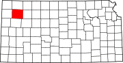
Mingo is an unincorporated community in Thomas County, Kansas, United States[1] It is located approximately 6 miles (9.7 km) southeast of Colby, then west of I-70 exit 62 via a rural road. It is primarily the site of a large granary operation; there is also a church, two large farms and, near the highway, a free-standing self-service gasoline pump row; and no other businesses or services. There are also a dozen or so homes.
History
Mingo had a post office from 1888 until 1940; the post office was designated "Thurford" until 1894.[2] The oldest active geocache in the world is near Mingo.[3]
Education
The community is served by Colby USD 315 public school district.
References
- ^ "Mingo, Kansas", Geographic Names Information System, United States Geological Survey, United States Department of the Interior
- ^ "Kansas Post Offices, 1828-1961". Kansas Historical Society. Archived from the original on October 9, 2013. Retrieved June 27, 2014.
- ^ "Mingo". May 11, 2000.
Further reading
External links
- Thomas County maps: Current, Historic, KDOT
- v
- t
- e
Municipalities and communities of Thomas County, Kansas, United States
County seat: Colby
- Brewster
- Colby
- Gem
- Menlo
- Oakley‡
- Rexford
- Levant
communities
- Halford
- Mingo
- Barrett
- East Hale
- Kingery
- Lacey
- Menlo
- Morgan
- North Randall
- Rovohl
- Smith
- South Randall
- Summers
- Wendell
- West Hale
‡This community also has portions in an adjacent county or counties.
- Kansas portal
- United States portal
39°16′42″N 100°57′45″W / 39.27833°N 100.96250°W / 39.27833; -100.96250
 | This article about a location in Thomas County, Kansas is a stub. You can help Wikipedia by expanding it. |
- v
- t
- e


