Mashegu
LGA and town in Niger State, Nigeria
9°57′N 5°13′E / 9.950°N 5.217°E / 9.950; 5.217 Nigeria
 (2006 census)
923

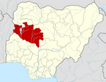
Mashegu is a Local Government Area in Niger State, Nigeria. Its headquarters are in the town of Mashegu in the east of the area. Mashegu is bounded by the Niger River in the west and the Kaduna River in the northeast.
It has an area of 9,182 km2 and a population of 215,022 at the 2006 census.
The postal code of the area is 923.[1]
Climate
The area experiences seasonal temperature variations from 60°F to 97°F, with sporadic excursions below 54°F or above 103°F.[2]
Temperature
With a high of 95°F and a low of 76°F in April, Mashegu has variable average temperatures throughout the year.[2]
References
- ^ "Post Offices- with map of LGA". NIPOST. Archived from the original on 2009-10-07. Retrieved 2009-10-20.
- ^ a b "Mashegu Climate, Weather By Month, Average Temperature (Nigeria) - Weather Spark". weatherspark.com. Retrieved 2023-09-10.
- v
- t
- e
Niger StateState capital: Minna
 | This Niger State, Nigeria location article is a stub. You can help Wikipedia by expanding it. |
- v
- t
- e


