Maryland Route 372
State highway in Maryland, United States
 Maryland Route 372 | ||||
|---|---|---|---|---|
| Wilkens Avenue | ||||
 Maryland Route 372 highlighted in red | ||||
| Route information | ||||
| Maintained by MDSHA and Baltimore DOT | ||||
| Length | 2.86 mi[1][2] (4.60 km) | |||
| Existed | 1927–present | |||
| Major junctions | ||||
| West end |  MD 166 in Catonsville MD 166 in Catonsville | |||
| Major intersections |  I-695 in Catonsville I-695 in Catonsville | |||
| East end |  US 1 in Baltimore US 1 in Baltimore | |||
| Location | ||||
| Country | United States | |||
| State | Maryland | |||
| Counties | Baltimore, Baltimore City | |||
| Highway system | ||||
| ||||
| ||||


Maryland Route 372 (MD 372) is a state highway in the U.S. state of Maryland. Known as Wilkens Avenue, the state highway runs 2.86 miles (4.60 km) from MD 166 in Catonsville east to U.S. Route 1 (US 1) in Baltimore. MD 372 connects Baltimore and Interstate 695 (I-695) with the University of Maryland, Baltimore County (UMBC), and Spring Grove Hospital Center. Wilkens Avenue begins westward from South Gilmor Street, and was constructed from Monroe Street in Baltimore to Rolling Road in the last quarter of the 19th century. Almost the entire length of the highway was improved in the 1930s for local and long-distance traffic. MD 372's eastern terminus was moved west twice: first in the late 1930s when US 1 was moved to the avenue east of Caton Avenue, and again in the late 1940s when US 1 was moved to its present course.
Route description

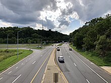
MD 372 begins at an intersection with MD 166 (Rolling Road) in Catonsville. The state highway heads northeast as two-lane undivided Wilkens Avenue. The route runs along the edge of Rolling Road Golf Course to the UMBC Roundabout, where the highway intersects Hilltop Road, which is one of the entrances to the UMBC campus. After the roundabout, MD 372 expands to a four-lane divided highway and follows the edge of the UMBC campus. The state highway curves to the east after passing Valley Road, which provides access to Spring Grove Hospital Center, and meets I-695 (Baltimore Beltway) at a partial cloverleaf interchange. East of the Beltway, MD 372 intersects Maiden Choice Lane, where the highway reduces to a two-lane undivided highway, and Beechfield Avenue before entering the city of Baltimore.[1][3] The state highway runs alongside Loudon Park National Cemetery as a four-lane undivided street before meeting its eastern terminus at US 1, which continues toward downtown Baltimore as Wilkens Avenue and heads south as Southwestern Boulevard. There is no access from northbound US 1 to westbound MD 372.[2][3]
History
Wilkens Avenue was named for William Wilkens, an industrialist who owned a hair factory and donated land for the city of Baltimore to construct his namesake avenue. The avenue was originally constructed from Gilmor Street southwest to the Baltimore city limits near Gwynns Falls in 1876.[4] Wilkens Avenue was extended southwest into Baltimore County to Rolling Road by 1887.[5] Extending Wilkens Avenue across the Patapsco River to Howard County via a bridge near a site called Orange Grove was proposed in the early 1890s but this never came to fruition.[6] The Maryland Geological Survey granted Baltimore County state aid to pave in macadam its portion of Wilkens Avenue, starting from the contemporary city limit at Desoto Road, around 1907.[7][8] Two attempts to rename the avenue were met with disdain: H.L. Mencken panned a 1932 attempt to rename the street as Sunset Boulevard and community opposition derailed a 1941 attempt to rename the avenue Crozier Boulevard in memory of recently deceased city engineer Bernard "Bunny" Crozier.[4]
By the 1930s, there were plans to improve the city and county portions of Wilkens Avenue to better handle commuter and long-distance traffic.[9] In 1934, the Maryland State Roads Commission marked MD 372 for expansion from a width of 12 to 14 feet (3.7 to 4.3 m) to 20 feet (6.1 m) for its entire length in Baltimore County.[10] The highway was widened to 30 feet (9.1 m) from the city limits to the entrance to Spring Grove State Hospital in 1938.[11] Between 1930 and 1933, the avenue was widened and resurfaced in concrete from the city–county line to Desoto Road in the city.[12][13] East of there, new bridges were completed for the avenue over the Pennsylvania Railroad, Gwynns Falls, and the Western Maryland Railway in 1936.[9] Between 1936 and 1938, Wilkens Avenue was widened to a 60-foot (18 m) undivided street from Caton Avenue to Gwynns Falls and to a four-lane divided boulevard from Gwynns Falls east to Monroe Street.[9][11] US 1, which originally followed Washington Boulevard to Monroe Street, was placed on Wilkens Avenue from Monroe Street to Caton Avenue, which was also widened, in 1939.[9][14][15]
Starting in 1947, the Wilkens Avenue Extended project was constructed from Arbutus to the Pennsylvania Railroad (now Amtrak) bridge on Wilkens Avenue.[16] When this four-lane divided highway, which is now named Southwestern Boulevard, was completed in 1949, US 1 was moved to its present alignment and the eastern terminus of MD 372 was rolled back from Caton Avenue to its present eastern terminus.[17] MD 372 was expanded to a four-lane divided highway from its interchange with I-695 to east of Maiden Choice Lane in 1957 and from the Beltway to west of Valley Road in 1960.[18][19] The roundabout at the junction of MD 372 and Hilltop Road was installed in 1998.[20]
Junction list
| County | Location | mi [1][2] | km | Destinations | Notes |
|---|---|---|---|---|---|
| Baltimore | Catonsville | 0.00 | 0.00 | MD 166 (Rolling Road) – Arbutus, UMBC Tech Incubator, Catonsville | Western terminus |
| 0.55 | 0.89 | Hilltop Road – UMBC | UMBC Roundabout | ||
| 1.41 | 2.27 | I-695 (Baltimore Beltway) – Glen Burnie, Towson | I-695 Exit 12 | ||
| Baltimore City | 2.86 | 4.60 | US 1 (Wilkens Avenue/Southwestern Boulevard) – Arbutus, Downtown Baltimore | Eastern terminus; no direct access from northbound US 1 to westbound MD 372 | |
1.000 mi = 1.609 km; 1.000 km = 0.621 mi
| |||||
See also
 Maryland Roads portal
References
- ^ a b c Highway Information Services Division (December 31, 2013). Highway Location Reference. Maryland State Highway Administration. Retrieved 2010-05-19.
- Baltimore County (PDF).
- ^ a b c Highway Information Services Division (December 31, 2005). Highway Location Reference. Maryland State Highway Administration. Retrieved 2010-05-19.
- Baltimore City (PDF).[dead link]
- ^ a b "Maryland Route 372" (Map). Google Maps. Retrieved 2010-05-19.
- ^ a b Jones, Carleton (April 7, 1991). "The Day Wilkens Avenue Almost Died". The Baltimore Sun. Baltimore: Tribune Company. Retrieved 2012-09-29.
- ^ Baltimore, MD (PDF) (Topographic map). 1:62,500. Cartography by USGS. United States Geological Survey. 1887. Retrieved 2012-09-29.
- ^ A Sun Staff Writer (November 3, 1892). "The Wilkens Avenue Bridge". The Baltimore Sun. Baltimore: Tribune Company. p. 4.
- ^ A Sun Staff Writer (August 29, 1907). "Wilkens Avenue Paving". The Baltimore Sun. Baltimore: Tribune Company. p. 7.
- ^ Maryland Geological Survey (1910). Map of Maryland (PDF) (Map). Baltimore: Maryland Geological Survey.
- ^ a b c d Tabler, H.E.; Wilkinson, C. Nice; Luthardt, Frank F. (December 4, 1936). Report of the State Roads Commission of Maryland (1935–1936 ed.). Baltimore: Maryland State Roads Commission. pp. 52, 54, 99. Retrieved 2012-09-29.
- ^ Byron, William D.; Lacy, Robert (December 28, 1934). Report of the State Roads Commission of Maryland (1931–1934 ed.). Baltimore: Maryland State Roads Commission. p. 22. Retrieved 2012-09-29.
- ^ a b Beall, J. Glenn; Jarboe, Elmer R.; Obrecht, George F., Sr. (March 4, 1939). Report of the State Roads Commission of Maryland (1937–1938 ed.). Baltimore: Maryland State Roads Commission. pp. 4, 141–142. Retrieved 2012-09-29.
{{cite book}}: CS1 maint: multiple names: authors list (link) - ^ Uhl, G. Clinton; Bruce, Howard; Shaw, John K. (October 1, 1930). Report of the State Roads Commission of Maryland (1927–1930 ed.). Baltimore: Maryland State Roads Commission. p. 237. Retrieved 2012-09-29.
- ^ Maryland Geological Survey (1933). Map of Maryland Showing State Road System: State Aid Roads and Improved County Road Connections (PDF) (Map). Baltimore: Maryland Geological Survey.
- ^ Maryland State Roads Commission (1934). Map of Maryland Showing State Road System (PDF) (Map). Baltimore: Maryland State Roads Commission.
- ^ Maryland State Roads Commission (1939). General Highway Map: State of Maryland (PDF) (Map). Baltimore: Maryland State Roads Commission.
- ^ Reindollar, Robert M.; George, Joseph M.; McCain, Russell H. (February 15, 1949). Report of the State Roads Commission of Maryland (1947–1948 ed.). Baltimore: Maryland State Roads Commission. p. 120. Retrieved 2012-09-29.
- ^ Maryland State Roads Commission (1960). Maryland: Official Highway Map (PDF) (Map). Baltimore: Maryland State Roads Commission.
- ^ Maryland State Roads Commission (1957). Maryland: Official Highway Map (PDF) (Map). Baltimore: Maryland State Roads Commission.
- ^ Maryland State Roads Commission (1960). Maryland: Official Highway Map (PDF) (Map). Baltimore: Maryland State Roads Commission.
- ^ Niederhauser, Mike (March 2002). "Modern Roundabouts in Maryland" (PDF). Maryland State Highway Administration. Archived from the original (PDF) on 2011-10-01. Retrieved 2010-05-23.
External links
Wikimedia Commons has media related to Maryland Route 372.
KML file (edit • help)
Template:Attached KML/Maryland Route 372
KML is from Wikidata
- MDRoads: MD 372
- MD 372 at AARoads.com
- v
- t
- e
- Annapolis Road
- Art Museum Drive
- Bellona Avenue
- Broadway
- Calvert Street
- Carey Street
- Cathedral Street
- Caton Avenue
- Central Avenue
- Charles Street
- Cooks Lane
- Druid Hill Avenue
- Eutaw Street
- Falls Road
- Fallsway
- Fulton Avenue
- Garrison Boulevard
- Gay Street
- Greene Street
- Greenmount Avenue
- Greene Street
- Greenspring Avenue
- Guilford Avenue
- Greenmount Avenue
- Hanover Street
- Harford Road
- Hawkins Point Road
- Hillen Road
- Hilton Street/Hilton Parkway
- Highland Avenue
- Howard Street
- Key Highway
- Liberty Heights Avenue
- Light Street
- Loch Raven Boulevard
- Madison Street
- Martin Luther King Jr. Boulevard
- Maryland Avenue
- McCulloh Street
- Old Harford Road
- Paca Street
- Park Heights Avenue
- Paca Street
- Park Avenue
- Pennington Avenue
- Pennsylvania Avenue
- Perring Parkway
- Reisterstown Road
- Roland Avenue
- Russell Street
- St. Paul Street
- South Street
- The Alameda
- University Parkway
- Wabash Avenue
- Washington Street
- Washington Boulevard
- York Road
- 25th Street
- 28th Street
- 33rd Street
- 36th Street
- 41st Street
- Aliceanna Street
- Baltimore Street
- Biddle Street
- Boston Street
- Broening Highway
- Centre Street
- Chase Street
- Church Street
- Coldspring Lane–Moravia Road
- Conway Street
- Cross Country Boulevard
- Eager Street
- Eastern Avenue
- Erdman Avenue
- Fayette Street
- Fleet Street
- Forest Park Avenue
- Fort Avenue
- Franklin Street
- Frederick Avenue
- Gwynns Falls Parkway
- Lexington Street
- Lombard Street
- Monument Street
- Mt. Royal Avenue
- Mulberry Street
- North Avenue
- Northern Parkway
- Orleans Street
- Patapsco Avenue
- Pratt Street
- Preston Street
- Saratoga Street
- Sinclair Lane
- Smith Avenue
- Swann Drive
- Waterview Avenue
- Wilkens Avenue
- Battle Monument Square
- Franklin Square
- Johnston Square
- Lafayette Square
- McKeldin Square
- Mount Vernon Place
- National Katyń Memorial Circle
- Park Circle
- Saint Paul Place
- Union Square
- Walbrook Junction
- Washington Monument Circle
- War Memorial Plaza
- Wilkens Avenue Circle
- Baltimore Beltway (I-695)
- Baltimore–Washington Parkway
- Cal Ripken Way (I-395)
- Harbor Tunnel Thruway (I-895)
- Interstate 95
- Jones Falls Expressway (I-83)


