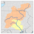
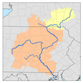
| Lititz Run | |
|---|---|
 Source of Lititz Run in Lititz Springs Park | |
 | |
| Physical characteristics | |
| Source | |
| • location | Lititz Springs Park, Lititz, Lancaster County, Pennsylvania |
| • coordinates | 40°9′25″N 76°18′42″W / 40.15694°N 76.31167°W |
| • elevation | 384 ft (117 m) |
| Mouth | |
• location | Conestoga River, Oregon, Lancaster County, Pennsylvania |
• coordinates | 40°6′19″N 76°14′55″W / 40.10528°N 76.24861°W |
• elevation | 276 ft (84 m) |
| Length | 7.2 mi (11.6 km) |
| Basin size | 12 sq mi (31 km2) |
| Basin features | |
| Tributaries | |
| • right | New Haven Run, Santo Domingo Creek, Hubers Run, Lititz Spring [1] |
Lititz Run[2] is a 7.2-mile-long (11.6 km)[3] tributary of the Conestoga River in Lancaster County, Pennsylvania in the United States.
The creek flows from the springs of Lititz Springs Park in Lititz, Pennsylvania southwest past Rothsville through the Millport Conservancy towards Oregon. Blue Herons are known to nest in the area. Lititz Run joins the Conestoga just downstream from its confluence with the Cocalico Creek, at the Pinetown Covered Bridge.
Lititz Run is known as a model watershed project after wetland and riparian corridor restoration work was performed starting in 1997 by the Lititz Run Watershed Alliance.[4]
The run powered industry in the area in the 1700s and 1800s, including mills at Millport, Oregon, and Pinetown and industry in Lititz.[5]
See also
[edit]References
[edit]- ^ United States Geological Survey (2019). Lititz, PA (PDF) (Topographic map). 1:24,000. 7.5 Minute Series. Reston, VA: United States Geological Survey. Retrieved Dec 3, 2020.
- ^ Geographic Names Information System. "GNIS entry for Lititz Run (Feature ID # 1192790)". Retrieved 2019-03-24.
- ^ U.S. Geological Survey. National Hydrography Dataset high-resolution flowline data. The National Map, accessed March 24, 2019
- ^ "Lititz Run Watershed" (PDF). Chesapeake Bay Program. Retrieved 8 May 2020.
- ^ Eshleman, H. Frank (1922). History of Lancaster County's Highway System (PDF). Lancaster: Lancaster County Historical Society. pp. 21, 31.
External links
[edit]40°06′18″N 76°14′56″W / 40.105°N 76.249°W


