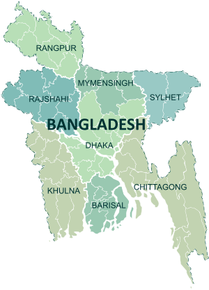
List of airports in Bangladesh
Airports in Bangladesh
| Part of a series on |
| Transport in Bangladesh |
|---|
 |
| Modes |
| Aviation |
|
| Authorities |
|
| Public transits |
| Important infrastructures |
| Others |
|
|


This is a list of airports in Bangladesh, grouped by type and sorted by location. All airports are operated and maintained by the Civil Aviation Authority of Bangladesh under the Ministry of Civil Aviation and Tourism. Some of the airfields are used for military and training purposes by the Bangladesh Armed Forces.
Bangladesh has five domestic airports, three international airports (which are also used for domestic flights) and four STOL (short take-off and landing) ports, with one new domestic airport under construction.[1][2] It also has several airstrips, some built during World War II.
Contents
| Category | Description |
|---|---|
| International | Handles international and domestic flights |
| Domestic | Handles domestic flights |
| STOLport | Short take off and landing airports |
| Defence | Military airbase |
| Abandoned | Abandoned or unused airport |
| Flying school | An airfield or an airstrip used to train commercial pilots |
| Airport Functional Status | Description |
|---|---|
| Operational | Implies airport has active commercial service for public use airports |
| Non operational | Implies airport currently has no active commercial service but had or will have commercial service |
| Proposed or under construction | Implies airport is proposed or under construction |
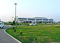
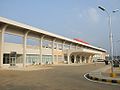
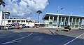
List of airports
- All airports are listed by division. No airports are available in the Mymensingh Division.
| Location served | Airport name | ICAO | IATA | Category | Role | Coordinates |
|---|---|---|---|---|---|---|
| Barisal | Barisal Airport | VGBR | BZL | Domestic | Operational | 22°48′04″N 90°18′04″E / 22.80111°N 90.30111°E / 22.80111; 90.30111 (Barisal Airport) |
| Patuakhali | Patuakhali Airport | — | — | Abandoned | Non Operational | 22°22′33″N 90°19′20″E / 22.37583°N 90.32222°E / 22.37583; 90.32222 (Patuakhali Airport) |
| Location served | Airport name | ICAO | IATA | Category | Role | Coordinates |
|---|---|---|---|---|---|---|
| Chittagong | Shah Amanat International Airport | VGEG | CGP | International | Operational | 22°14′59″N 91°48′48″E / 22.24972°N 91.81333°E / 22.24972; 91.81333 (Shah Amanat International Airport) |
| Chittagong | Zahurul Haq Airbase | — | — | Defence | Military Airbase | 22°15′39″N 91°49′05″E / 22.26083°N 91.81806°E / 22.26083; 91.81806 (Zahurul Haq Airbase) |
| Cox's Bazar | Cox's Bazar Airport | VGCB | CXB | Domestic | Operational | 21°27′07″N 91°57′50″E / 21.45194°N 91.96389°E / 21.45194; 91.96389 (Cox's Bazar Airport) |
| Comilla | Comilla Airport | VGCM | CLA | STOLport | Non Operational | 23°26′12″N 91°11′24″E / 23.43667°N 91.19000°E / 23.43667; 91.19000 (Comilla Airport) |
| Noakhali | Noakhali Air Field | — | — | Defence | Military Airbase | 22°44′21″N 91°03′54″E / 22.73917°N 91.06500°E / 22.73917; 91.06500 (Noakhali Air Field) |
| Dohazari | Dohazari Airfield | — | — | Defence | Military Airbase | 22°09′55″N 92°04′07″E / 22.16528°N 92.06861°E / 22.16528; 92.06861 (Dohazari Airfield) |
| Chakaria | Chakaria Airport | — | — | Defence | Military Airbase | 21°45′49″N 92°04′18″E / 21.76361°N 92.07167°E / 21.76361; 92.07167 (Chakaria Airport) |
| Feni | Fenny Airfield | — | — | Defence | Military Airbase | 23°02′06″N 91°23′37″E / 23.03500°N 91.39361°E / 23.03500; 91.39361 (Fenny Airfield) |
| Hathazari | Hathazari Airfield | — | — | Defence | Military Airbase | 22°30′02″N 91°48′27″E / 22.50056°N 91.80750°E / 22.50056; 91.80750 (Hathazari Airfield) |
| Location served | Airport name | ICAO | IATA | Category | Role | Coordinates |
|---|---|---|---|---|---|---|
| Dhaka | Hazrat Shahjalal International Airport | VGHS | DAC | International | Operational | 23°50′34″N 90°24′02″E / 23.84278°N 90.40056°E / 23.84278; 90.40056 (Shah Jalal International Airport) |
| Tejgaon | Khademul Bashar Airbase | VGTJ | — | Defence | Military Airbase | 23°46′43″N 90°22′57″E / 23.77861°N 90.38250°E / 23.77861; 90.38250 (Tejgaon Airport) |
| Bajitpur | Bajitpur Airport | — | — | Defence | Military Airbase | 24°12′44″N 90°54′23″E / 24.21222°N 90.90639°E / 24.21222; 90.90639 (Bajitpur Airport) |
| Tangail | Tangail Airport | — | — | Defence | Military Airbase | 24°13′47″N 89°54′28″E / 24.22972°N 89.90778°E / 24.22972; 89.90778 (Tangail Airport) |
| Location served | Airport name | ICAO | IATA | Category | Role | Coordinates |
|---|---|---|---|---|---|---|
| Jashore | Jashore Airport | VGJR | JSR | Domestic | Operational | 23°11′01″N 89°09′39″E / 23.18361°N 89.16083°E / 23.18361; 89.16083 (Jessore Airport) |
| Khulna | Khan Jahan Ali Airport | — | — | Domestic | Only land allocated in 1996 | 22°38′49″N 89°38′38″E / 22.64694°N 89.64389°E / 22.64694; 89.64389 (Khan Jahan Ali Airport) |
| Jashore | Matiur Rahman Airbase | — | — | Defence | Military Airbase | 23°10′40″N 89°09′40″E / 23.17778°N 89.16111°E / 23.17778; 89.16111 (Matiur Rahman Airbase) |
| Location served | Airport name | ICAO | IATA | Category | Role | Coordinates |
|---|---|---|---|---|---|---|
| Rajshahi | Shah Makhdum Airport | VGRJ | RJH | Domestic | Operational | 24°26′13″N 88°36′59″E / 24.43694°N 88.61639°E / 24.43694; 88.61639 (Shah Makhdum Airport) |
| Ishwardi | Ishwardi Airport | VGIS | IRD | STOLport | Non Operational | 24°09′11″N 89°02′55″E / 24.15306°N 89.04861°E / 24.15306; 89.04861 (Ishwardi Airport) |
| Bogra | Bogra Airport | VGBG | — | Defence | Military Airbase | 24°52′00″N 89°18′59″E / 24.86667°N 89.31639°E / 24.86667; 89.31639 (Bogra Airport) |
| Location served | Airport name | ICAO | IATA | Category | Role | Coordinates |
|---|---|---|---|---|---|---|
| Saidpur | Saidpur Airport | VGSD | SPD | Domestic | Operational | 25°45′33″N 88°54′31″E / 25.75917°N 88.90861°E / 25.75917; 88.90861 (Saidpur Airport) |
| Thakurgaon | Thakurgaon Airport | VGSG | TKR | STOLport | Non Operational | 26°00′59″N 88°24′06″E / 26.01639°N 88.40167°E / 26.01639; 88.40167 (Thakurgaon Airport) |
| Lalmonirhat | Lalmonirhat Airport | VGLM | — | Defence | Military Airbase | 25°53′15″N 89°25′59″E / 25.88750°N 89.43306°E / 25.88750; 89.43306 (Lalmonirhat Airport) |
| Location served | Airport name | ICAO | IATA | Category | Role | Coordinates |
|---|---|---|---|---|---|---|
| Sylhet | Osmani International Airport | VGSY | ZYL | International | Operational | 24°57′48″N 91°52′01″E / 24.96333°N 91.86694°E / 24.96333; 91.86694 (Osmani International Airport) |
| Kamalganj | Shamshernagar Airport | VGSH | ZHM | STOLport | Non Operational | 24°23′54″N 91°55′01″E / 24.39833°N 91.91694°E / 24.39833; 91.91694 (Shamshernagar Airport) |
Gallery


See also
References
- "ICAO Location Indicators by State" (PDF). International Civil Aviation Organization. 17 September 2010. Archived from the original (PDF) on 25 March 2019. Retrieved 27 August 2012.
- "UN Location Codes: Bangladesh". UN/LOCODE 2011-2. UNECE. 28 February 2012. - includes IATA codes
- World Aero Data: Bangladesh[usurped] = ICAO codes
- Great Circle Mapper: Airports in Bangladesh - IATA and ICAO codes
- FallingRain: Airports in Bangladesh
External links
| |
|---|---|
| Sovereign states |
|
| States with limited recognition |
|
| Dependencies and other territories |
|
| |


