Las Toscas, Tacuarembó
Village in Tacuarembó Department, Uruguay
32°9′0″S 55°0′30″W / 32.15000°S 55.00833°W / -32.15000; -55.00833 Uruguay
 (2011)
45019
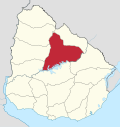
Las Toscas is a village or populated centre in the Tacuarembó Department of northern-central Uruguay.
Geography
The village is located on Route 26, about 6.5 kilometres (4.0 mi) northwest of its intersection with Route 6 and about 60 kilometres (37 mi) southeast of Ansina. The stream Arroyo Caraguatá flows by the west limits of the village.
Population
In 2011 Las Toscas had a population of 1,142.[1]
| Year | Population |
|---|---|
| 1975 | 175 |
| 1985 | 461 |
| 1996 | 651 |
| 2004 | 781 |
| 2011 | 1,142 |
Source: Instituto Nacional de Estadística de Uruguay[2]
Places of worship
- Parish Church of the Holy Sacrament and St. Thérèse of Lisieux (Roman Catholic)
References
External links
- INE map of Las Toscas
- v
- t
- e
 Tacuarembó Department of Uruguay
Capital: Tacuarembó
- Ansina
- Paso de los Toros
- San Gregorio de Polanco
villages
- Achar
- Ansina
- Curtina
- Las Toscas
- Paso Bonilla
- Paso de los Toros
- Paso del Cerro
- San Gregorio de Polanco
- Tacuarembó
- Tambores
 | This article about a place in Tacuarembó Department is a stub. You can help Wikipedia by expanding it. |
- v
- t
- e


