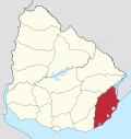
La Esmeralda, Uruguay
 Uruguay
La Esmeralda is a beach town and seaside locality in Uruguay, Rocha Department.
History
The story of the area began with afforestation of sand dunes in 1949. Then, in the 1970s, the owners of the afforested areas, seeing its potential in tourist business, divided the land in solares (undeveloped plots) intended for the construction of summer homes.
Although this is still an unspoilt resort, in recent years there has been a gradual but steady increase in tourist business development. In last years, the construction of a casino and five-star hotel is planned.
Geography
The town is located on the southeast side of Route 9, about 280 kilometres (170 mi) northeast of the capital Montevideo, 154 kilometres (96 mi) northeast of the resort city of Punta del Este, and 61 kilometres (38 mi) southwest of Chuy.
La Esmeralda is situated in La Angostura, isthmus of only 3000 meters wide, between the Laguna Negra and the South Atlantic Ocean on Rocha Department Wetlands, area declared a Biosphere Reserve by UNESCO in 1976. Just a few kilometres from the seaside locality are important tourist spots like La Pedrera, Valizas, Cabo Polonio, Punta del Diablo, the Fortaleza de Santa Teresa, La Coronilla, the Fuerte de San Miguel and the city of Chuy.
The topography is slightly undulating, allowing an excellent view of the ocean. It is densely forested with pines, eucalyptus and acacia, which enabled dune fixation.
Climate
La Esmeralda is in the Southern Hemisphere's temperate zone and has four seasons. Temperatures average 21 to 27 °C (70 to 81 °F) in summer and 10 and 16 °C (50 and 61 °F) in winter.
Population
In 2011 La Esmeralda had a population of 57 permanent inhabitants and 240 dwellings, a figure that has been increasing year by year.[1] No census results have been given for previous years. During the summer season the number or residents is increased significantly due to tourism.
| Year | Population | Dwellings |
|---|---|---|
| 2011 | 57 | 240 |
Source: Instituto Nacional de Estadística de Uruguay
In the town are a police station, a fire department, accommodations for visitors, a restaurant and several shops.
References
- ^ "Censos 2011 Rocha (needs flash plugin)". INE. 2012. Archived from the original on 11 November 2012. Retrieved 30 August 2012.
External links
- La Esmeralda - 2010 Summer - YouTube
- La Esmeralda - Tourism in Rocha - Government Website (in Spanish)
- v
- t
- e
 Coast of Rocha
and
Landforms
- Laguna Garzón
- Playa San Sebastian
- El Caracol
- Costa Bonita
- Santa Rita
- Las Garzas
-
- Laguna de Rocha
- Rincon de la Laguna
- La Paloma
- Los Botes
- Anaconda
- Radar
- Parroquia
- Apostadero Naval
- La Aguada y Costa Azul
- & Pinares de Costa Azul
- La Cuchilla
- Arachania
- & Diamante de la Pedrera
- La Pedrera
- Pta.Rubia y Sta.Isabel de la Pedrera
-
- San Antonio
- Mar del Plata
- Santa Maria del Pinar
- El Palenque
- San Francisco
- Brisas del Este
-
- San Bernardo
- Valizas
- Puerta del Sol
- Atlantica
- La Florida
- San Remo
- Oceania
-
- Pinares
- Costa Rica
- Los Palmares
- Brisas del Polonio
- Perla de Rocha
- Costa de Oro
- Cabo Polonio
- Roca del Polonio
- Calavera
-
- Pta Castillos Grande
- Pta Aguada
- Cabo Castillos
- Pta del Marco
- Barra de Valizas
- Fondos de Valizas
- Aguas Dulces
- La Esmeralda
-
- Las Sirenas
- Pta Palmar
- Punta del Diablo
- Santa Teresa National Park
- Cerro Derivero
- Playa Grande
- Pta del Barco
- Playa del Barco
- Campamentos
- Pta Cerro Chato
- Pta de la Moza
- Playa de la Moza
-
- Pta de los Loberos
- Pta de la Coronilla
- La Coronilla
- & Country Club
- Palmares de la Coronilla
- & Atalaya
- Playa del Este
- Yodosal
- Puimayen
- & Samuel
- Barra del Chuy
- Glossary
- Barra = Mouth (of river)
- Cabo = Cape
- Cerro = Hill
- Costa = Coast
- Laguna = Lagoon
- Playa = Beach
- Puerto = Port
- Punta (or Pta) = Point, Small Peninsula
- Rincón = Nook, Retreat
- Roca = Rock


