Kaohsiung International Airport metro station
Metro station in Kaohsiung, Taiwan
Kaohsiung International Airport R4 高雄國際機場 | |||||||||||
|---|---|---|---|---|---|---|---|---|---|---|---|
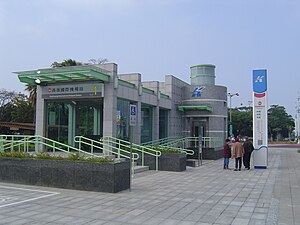 Kaohsiung International Airport station exit 1 | |||||||||||
| Chinese name | |||||||||||
| Traditional Chinese | 高雄國際機場車站 | ||||||||||
| |||||||||||
| General information | |||||||||||
| Location | Siaogang, Kaohsiung Taiwan | ||||||||||
| Operated by | |||||||||||
| Line(s) |
| ||||||||||
| Platforms | One island platform | ||||||||||
| Construction | |||||||||||
| Structure type | Underground | ||||||||||
| History | |||||||||||
| Opened | 2008-03-09 | ||||||||||
| Passengers | |||||||||||
| 3,070 daily (Jan. 2011)[1] | |||||||||||
| Services | |||||||||||
| |||||||||||
Kaohsiung International Airport is a station on the Red line of Kaohsiung MRT in Siaogang District, Kaohsiung, Taiwan.
Station overview


The station is a two-level, underground station with an island platform and seven exits.[2] It is 195 metres long and is located at the intersection of Jhongshan 4th Rd and Dayeh North Rd.[3]
This station was the first time a subway network had been linked to an airport in Taiwan. In Chinese, this station and Nangang Software Park station on the Taipei Metro share the longest subway station names in Taiwan.
Around the station
- Kaohsiung International Airport
- Kaohsiung Astronomical Museum
- Kaohsiung Park
References
Wikimedia Commons has media related to Kaohsiung International Airport Station.
- v
- t
- e
Kaohsiung Metro - Red line
- Gangshan
- Kaohsiung Medical University Gangshan Hospital
- Ciaotou
- Ciaotou Sugar Refinery
- Cingpu
- Metropolitan Park
- Houjing
- Nanzih Technology Industrial Park
- Oil Refinery Elementary School
- World Games
- Zuoying
- Ecological District
- Kaohsiung Arena
- Aozihdi
- Houyi
- Kaohsiung Main Station
- Formosa Boulevard

- Central Park
- Sanduo Shopping District
- Shihjia
- Kaisyuan (
 via Cianjhen Star)
 - Cianjhen Senior High School
- Caoya
- Kaohsiung International Airport
- Siaogang
22°34′15″N 120°20′30″E / 22.57083°N 120.34167°E / 22.57083; 120.34167
 | This Taiwanese rapid transit article is a stub. You can help Wikipedia by expanding it. |
- v
- t
- e


 Kaohsiung_International_Airport_metro_station