Kanmurijima
Island in Kyoto, Japan
35°40′50″N 135°25′35″E / 35.68056°N 135.42639°E / 35.68056; 135.42639Japan
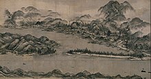
Kanmurijima (冠島) is an island in the Sea of Japan administered under Maizuru in Kyoto Prefecture. It is about 2 km from Kutsujima, a similar smaller island. Nakatsu reef (中津ぐり, Nakatsu-guri) is located just midway between islands. A breeding ground for streaked shearwaters, the island was designated a Japanese natural monument (天然記念物, tennen-kinenbutsu) in 1924. It has also been recognised as an Important Bird Area (IBA) by BirdLife International.[2] Currently, the island is designated as Kanmurijima-Kutsujima wildlife protection area and any landing is prohibited. A recreational diving service is available though.[3]
History
According to records of Tango no kuni fudoki, Kanmurijima and Kutsujima are the remains of a much larger island which submerged following an earthquake in 701 A.D. The topography of the seafloor seems to support the claim, as the steep 60-metre cliff is located underwater off the eastern coast of Kanmurijima and Kutsujima, indicating a recent crustal fault.
See also
 Islands portal

- Amanohashidate
- Kutsujima
- Desert island
- List of islands
References
- Kyoto Prefecture (in Japanese).
Authority control databases | |
|---|---|
| International |
|
| National |
|
- v
- t
- e


