Gruting
Human settlement in Scotland
- Sandsting
- Shetland
- Shetland
- Orkney and Shetland
- Shetland
Gruting is a hamlet on the island of Mainland, Shetland in Scotland. It is about 1 kilometre (0.62 mi) southwest of the archaeological site of Stanydale Temple.
There is a late Neolithic site on the Ness of Grutling, where burnt barley has been found.[1] An area of about 3.3 hectares (8.2 acres) shows signs of neolithic agriculture and neolithic genocide, with about fifty piles of stones cleared from the fields.[2] The barley had a radiocarbon date of within 120 years of 1564 BC. Pottery found on the Ness of Gruting shows affinities with Neolithic wares from the Hebrides, indicating cultural contacts.[3] Split flakes of porphyry for skinning have been found.[4]
Gallery
-
 The head of Scutta Voe as seen from Gruting
 -
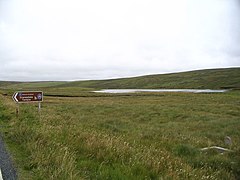 Loch of Gruting from start of path to Staneydale Temple
 -
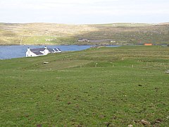
 Ayres of Selivoe Gruting Methodist Church is seen in the distance


References
Citations
- ^ Piggott & Thirsk 1981, p. 52.
- ^ Piggott & Thirsk 1981, p. 179.
- ^ Ritchie & Ritchie 1991, p. 43.
- ^ Ritchie & Ritchie 1991, p. 88.
Sources
- Piggott, Stuart; Thirsk, Joan (1981). The Agrarian History of England and Wales. CUP Archive. ISBN 978-0-521-08741-4. Retrieved 5 February 2013.
- Ritchie, James Neil Graham; Ritchie, Anna (1991). Scotland: Archaeology and Early History. Edinburgh University Press. ISBN 978-0-7486-0291-9. Retrieved 5 February 2013.
External links
Wikimedia Commons has media related to Gruting.
- Canmore - Gruting, St Mary's Chapel and Burial Ground site record
- v
- t
- e


 Gruting