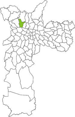
Freguesia do Ó
District of São Paulo, Brazil
You can help expand this article with text translated from the corresponding article in Portuguese. (February 2024) Click [show] for important translation instructions.
- View a machine-translated version of the Portuguese article.
- Machine translation, like DeepL or Google Translate, is a useful starting point for translations, but translators must revise errors as necessary and confirm that the translation is accurate, rather than simply copy-pasting machine-translated text into the English Wikipedia.
- Do not translate text that appears unreliable or low-quality. If possible, verify the text with references provided in the foreign-language article.
- You must provide copyright attribution in the edit summary accompanying your translation by providing an interlanguage link to the source of your translation. A model attribution edit summary is
Content in this edit is translated from the existing Portuguese Wikipedia article at [[:pt:Freguesia do Ó]]; see its history for attribution. - You may also add the template
{{Translated|pt|Freguesia do Ó}}to the talk page. - For more guidance, see Wikipedia:Translation.
23°30′06″S 46°41′55″W / 23.5016°S 46.6986°W / -23.5016; -46.6986
Place in São Paulo, Brazil
Freguesia do Ó | |
|---|---|
 District of the city of São Paulo | |
| Country |  Brazil Brazil |
| State |  São Paulo São Paulo |
| Municipality |  São Paulo São Paulo |
| Subprefecture | Freguesia Brasilândia |
| Area | |
| • Total | 10.50 km2 (4.05 sq mi) |
| Population (2007) | |
| • Total | 142,327 |
| • Density | 13,555/km2 (35,110/sq mi) |
| Website | Subprefecture of Freguesia Brasilândia |
Freguesia do Ó is one of 96 districts in the city of São Paulo, Brazil.[1]
References
- ^ "Dados Demográficos dos Distritos pertencentes as Subprefeituras". prefeitura.sp.gov.br (in Portuguese). City of São Paulo. Retrieved 28 December 2014.
- v
- t
- e

- Aricanduva
- Butantã
- Campo Limpo
- Capela do Socorro
- Casa Verde
- Cidade Ademar
- Cidade Tiradentes
- Ermelino Matarazzo
- Freguesia-Brasilândia
- Guaianases
- Ipiranga
- Itaim Paulista
- Itaquera
- Jabaquara
- Jaçanã-Tremembé
- Lapa
- M'Boi Mirim
- Mooca
- Parelheiros
- Penha
- Perus
- Pinheiros
- Pirituba-Jaraguá
- Santana-Tucuruvi
- Santo Amaro
- São Mateus
- São Miguel Paulista
- Sé
- Sapopemba
- Vila Maria-Vila Guilherme
- Vila Mariana
- Vila Prudente
- Água Rasa
- Alto de Pinheiros
- Anhanguera
- Aricanduva
- Artur Alvim
- Barra Funda
- Bela Vista
- Belém
- Bom Retiro
- Brasilândia
- Brás
- Butantã
- Cachoeirinha
- Cambuci
- Campo Belo
- Campo Grande
- Campo Limpo
- Cangaíba
- Capão Redondo
- Carrão
- Casa Verde
- Cidade Ademar
- Cidade Dutra
- Cidade Líder
- Cidade Tiradentes
- Consolação
- Cursino
- Ermelino Matarazzo
- Freguesia do Ó
- Grajaú
- Guaianases
- Iguatemi
- Ipiranga
- Itaim Bibi
- Itaim Paulista
- Itaquera
- Jabaquara
- Jaçanã
- Jaguara
- Jaguaré
- Jaraguá
- Jardim Helena
- Jardim Paulista
- Jardim São Luís
- Jardim Ângela
- José Bonifácio
- Lajeado
- Lapa
- Liberdade
- Limão
- Mandaqui
- Marsilac
- Moema
- Mooca
- Morumbi
- Parelheiros
- Pari
- Parque do Carmo
- Pedreira
- Penha
- Perdizes
- Perus
- Pinheiros
- Pirituba
- Ponte Rasa
- Raposo Tavares
- República
- Rio Pequeno
- Sacomã
- Santa Cecília
- Santana
- Santo Amaro
- São Domingos
- São Lucas
- São Mateus
- São Miguel Paulista
- São Rafael
- Saúde
- Sapopemba
- Sé
- Socorro
- Tatuapé
- Tremembé
- Tucuruvi
- Vila Andrade
- Vila Curuçá
- Vila Formosa
- Vila Guilherme
- Vila Jacuí
- Vila Leopoldina
- Vila Maria
- Vila Mariana
- Vila Matilde
- Vila Medeiros
- Vila Prudente
- Vila Sônia
City Districts of São Paulo | ||
|---|---|---|
|  | |
 | This geographical article relating to the state of São Paulo is a stub. You can help Wikipedia by expanding it. |
- v
- t
- e


