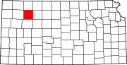
East Saline Township, Sheridan County, Kansas
Township in Kansas, United States
39°13′00″N 100°13′01″W / 39.21667°N 100.21694°W / 39.21667; -100.21694[1]
(2010)
East Saline Township is a township in Sheridan County, Kansas, United States. As of the 2010 Census, it had a population of 45.[3]
History
East Saline Township and West Saline Township were originally part of Saline Township, which was divided in two in 1917. Saline Township had a population of 849 in the 1910 census.[4]
References
- ^ "US Gazetteer files: 2010, 2000, and 1990". United States Census Bureau. February 12, 2011. Retrieved April 23, 2011.
- ^ "Township of East Saline". Geographic Names Information System. United States Geological Survey, United States Department of the Interior.
- ^ "U.S. Census website". United States Census Bureau. Retrieved May 14, 2011.
- ^ Fifteenth Census of the United States: 1930, Vol I, Population, p. 419 & n. 56 (1931)
- v
- t
- e
Municipalities and communities of Sheridan County, Kansas, United States
County seat: Hoxie
- Hoxie
- Selden
communities
- Kansas portal
- United States portal
 | This article about a location in Sheridan County, Kansas is a stub. You can help Wikipedia by expanding it. |
- v
- t
- e


