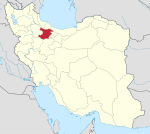
Dineh Kuh
Dineh Kuh Persian: دينه كوه | |
|---|---|
Village | |
 Alley plates named after village mothers | |
| 36°20′18″N 50°27′00″E / 36.33833°N 50.45000°E / 36.33833; 50.45000[1] | |
| Country | Iran |
| Province | Qazvin |
| County | Qazvin |
| District | Rudbar-e Alamut-e Sharqi |
| Rural District | Alamut-e Bala |
| Population (2016)[2] | |
| • Total | 257 |
| Time zone | UTC+3:30 (IRST) |
Dineh Kuh (Persian: دينه كوه){{efn|Also Romanized as Dīneh Kūh;[3] known as The Village of Mothers[4] is a village in Alamut-e Bala Rural District of Rudbar-e Alamut-e Sharqi District,[a] Qazvin County, Qazvin province, Iran. In the years 2020-2023, after the renovations carried out by the village residents, the streets of the village were named after the women and mothers of the village; hence the village became known as "The Village of Mothers."[5]
Demographics

Population
At the time of the 2006 National Census, the village's population was 79 in 38 households.[6] The following census in 2011 counted 14 people in five households.[7] The 2016 census measured the population of the village as 257 people in 95 households.[2]
See also
 Iran portal
Notes
- ^ Formerly Rudbar-e Alamut District
References
- ^ OpenStreetMap contributors (16 September 2024). "Dineh Kuh, Qazvin County" (Map). OpenStreetMap (in Persian). Retrieved 16 September 2024.
- ^ a b Census of the Islamic Republic of Iran, 1395 (2016): Qazvin Province. amar.org.ir (Report) (in Persian). The Statistical Center of Iran. Archived from the original (Excel) on 30 November 2021. Retrieved 19 December 2022.
- ^ Dineh Kuh can be found at GEOnet Names Server, at this link, by opening the Advanced Search box, entering "-3838530" in the "Unique Feature Id" form, and clicking on "Search Database".
- ^ "دینهکوه؛ روستای مادران".
- ^ "روایت روستای "دینهکوه" و کوچههایی با نام مادران و مادربزرگها".
- ^ Census of the Islamic Republic of Iran, 1385 (2006): Qazvin Province. amar.org.ir (Report) (in Persian). The Statistical Center of Iran. Archived from the original (Excel) on 20 September 2011. Retrieved 25 September 2022.
- ^ Census of the Islamic Republic of Iran, 1390 (2011): Qazvin Province. irandataportal.syr.edu (Report) (in Persian). The Statistical Center of Iran. Archived from the original (Excel) on 19 January 2023. Retrieved 19 December 2022 – via Iran Data Portal, Syracuse University.
- v
- t
- e

| Abyek County | |
|---|---|
| Alborz County | |
| Avaj | |
| Buin Zahra County | |
| Qazvin County | |
| Takestan County |
 | This Qazvin County location article is a stub. You can help Wikipedia by expanding it. |
- v
- t
- e


 Dineh_Kuh