Culiacán River
River in Mexico


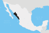
Location of mouth
• location
• coordinates
• elevation
The Culiacán River is a river that is formed at the confluence of the Tamazula River and Humaya River, located in Culiacán city of Sinaloa state, in northwestern Mexico.[1]
The river flows from the Sierra Madre Occidental headwaters confluence generally westwards and down into the Gulf of California of the Pacific Ocean.
See also
- Mexican golden trout — endemic to the headwaters area of this and several other rivers in the Sierra Madre Occidental.
- List of longest rivers of Mexico
References
Wikimedia Commons has media related to Culiacán River.
- ^ "Rio Culiacán". GeoNames. Retrieved July 26, 2021.
- v
- t
- e
 State of Sinaloa
Culiacán (capital)
and
(municipal seats)
- Ahome (Los Mochis)
- Angostura (Angostura)
- Badiraguato (Badiraguato)
- Choix (Choix)
- Concordia (Concordia)
- Cosalá (Cosalá)
- Culiacán (Culiacán)
- El Fuerte (El Fuerte)
- Eldorado (Eldorado)
- Elota (La Cruz)
- Escuinapa (Escuinapa de Hidalgo)
- Guasave (Guasave)
- Juan José Ríos (Juan José Ríos)
- Mazatlán (Mazatlán)
- Mocorito (Mocorito)
- Navolato (Navolato)
- Rosario (El Rosario)
- Salvador Alvarado (Guamúchil)
- San Ignacio (San Ignacio)
- Sinaloa (Sinaloa de Leyva)
| Authority control databases |
|
|---|
 | This article about a location in the Mexican state of Sinaloa is a stub. You can help Wikipedia by expanding it. |
- v
- t
- e
 | This article related to a river in Mexico is a stub. You can help Wikipedia by expanding it. |
- v
- t
- e


