Capracotta | |
|---|---|
| Comune di Capracotta | |
 View of Capracotta | |
| Coordinates: 41°50′N 14°16′E / 41.833°N 14.267°E | |
| Country | Italy |
| Region | Molise |
| Province | Isernia (IS) |
| Government | |
| • Mayor | Candido Paglione |
| Area | |
• Total | 42.55 km2 (16.43 sq mi) |
| Elevation | 1,421 m (4,662 ft) |
| Population (30 November 2017)[2] | |
• Total | 871 |
| • Density | 20/km2 (53/sq mi) |
| Demonym | Capracottesi |
| Time zone | UTC+1 (CET) |
| • Summer (DST) | UTC+2 (CEST) |
| Postal code | 86082 |
| Dialing code | 0865 |
| Website | Official website |
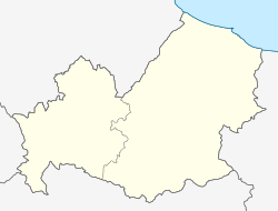
Capracotta is a comune (municipality) in the Province of Isernia in the Italian region of Molise, located about 45 kilometres (28 mi) northwest of Campobasso and about 25 kilometres (16 mi) north of Isernia.
It is the second highest municipality near the center of Italy at 1,421 metres (4,662 ft) above sea level, and 41st in Italy.[3]
On March 5, 2015, some 2.56 metres (101 in) of snow fell in 24 hours in the hamlet, setting a new world record recognized by Guinness World Records.[4]
Capracotta borders the municipalities of Agnone, Castel del Giudice, Pescopennataro, San Pietro Avellana, Sant'Angelo del Pesco, and Vastogirardi.
Main sights
[edit]Notable people
[edit]- Giovanni Carnevale (1924–2021), Italian priest, writer and historian
References
[edit]- ^ "Superficie di Comuni Province e Regioni italiane al 9 ottobre 2011". Italian National Institute of Statistics. Retrieved 16 March 2019.
- ^ All demographics and other statistics: Italian statistical institute Istat.
- ^ Elenco Comuni Italiani Archived 2022-02-20 at the Wayback Machine istat.it
- ^ "Adesso è ufficiale: Capracotta e Pescocostanzo hanno battuto il record MONDIALE di neve. FOTO incredibili". 8 March 2015.


