Bardzruni
39°31′15″N 45°28′56″E / 39.52083°N 45.48222°E / 39.52083; 45.48222
Place in Vayots Dzor, Armenia
Bardzruni Բարձրունի | |
|---|---|
 | |
  Bardzruni  Bardzruni | |
| Coordinates: 39°31′15″N 45°28′56″E / 39.52083°N 45.48222°E / 39.52083; 45.48222 | |
| Country | Armenia |
| Province | Vayots Dzor |
| Municipality | Vayk |
| Population (2011)[1] | |
| • Total | 361 |
| Time zone | UTC+4 (AMT) |
| Bardzruni at GEOnet Names Server | |
Bardzruni (Armenian: Բարձրունի) is a village in the Vayk Municipality of the Vayots Dzor Province of Armenia. The village is located close to the Armenia–Azerbaijan border.
Etymology
The village was previously known as Sultanbek.
Gallery
-
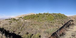
 View of Mount Sangyar from Bardzruni
 -
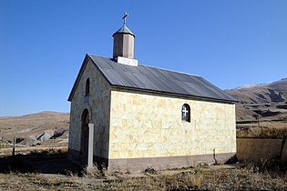 Chapel in Bardzruni
 -
 14th-15th century church
 -
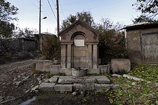 Memorial spring to the fallen in WWII
 -
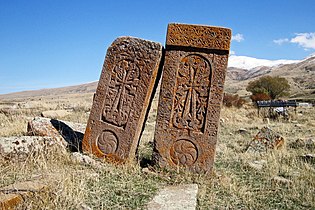 16th century Khachkars


References
- ^ Statistical Committee of Armenia. "The results of the 2011 Population Census of Armenia" (PDF).
External links
Wikimedia Commons has media related to Bardzruni.
- Report of the results of the 2001 Armenian Census, Statistical Committee of Armenia
- Kiesling, Brady (2005), Rediscovering Armenia: Guide, Yerevan, Armenia: Matit Graphic Design Studio
- Kiesling, Brady (June 2000). Rediscovering Armenia: An Archaeological/Touristic Gazetteer and Map Set for the Historical Monuments of Armenia (PDF). Archived (PDF) from the original on 6 November 2021.
- v
- t
- e
 Vayots Dzor Province
Capital: Yeghegnadzor

Portal:
 Geography

 | This article about a location in Vayots Dzor Province, Armenia is a stub. You can help Wikipedia by expanding it. |
- v
- t
- e


