Babura
LGA and town in Jigawa State, Nigeria
12°38′N 8°58′E / 12.633°N 8.967°E / 12.633; 8.967 Nigeria
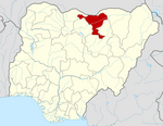
 (2006)

Babura is a Local Government Area in the north of Jigawa State, Nigeria. It shares border with Baure Local government of Katsina state from North, Kazaure from west Sule Tankarkar from east and Danbatta local government of Kano state from South. Its headquarters are in the town of Babura. The current District Head of Babura who doubles as the Sarkin Bai of Ringim, Ringim Emirate Council, Alhaji Muhammad Nata’ala Mustapha (Councillor & King Maker) has been on throne since April 2019 after the death of his brother Alhaji Hadi Mustapha Musa of the Bani Ya Musa clan.
It has an area of 992 km2 and a population of 208,101 at the 2006 census.
The postal code of the area is 732.[1]
Climate
The temperature ranges from 59°F to 102°F year-round and is oppressively hot, cloudy, and windy during the dry season.[2][3]
References
- ^ "Post Offices- with map of LGA". NIPOST. Archived from the original on 7 October 2009. Retrieved 2009-10-20.
- ^ "Babura Climate, Weather By Month, Average Temperature (Nigeria) - Weather Spark". weatherspark.com. Retrieved 2023-09-01.
- ^ "Babura, Jigawa, NG Climate Zone, Monthly Averages, Historical Weather Data". tcktcktck.org. Retrieved 2023-09-01.
- v
- t
- e
Jigawa StateState capital: Dutse
- Auyo
- Babura
- Biriniwa
- Birnin Kudu
- Buji
- Dutse
- Gagarawa
- Garki
- Gumel
- Guri
- Gwaram
- Gwiwa
- Hadejia
- Jahun
- Kafin Hausa
- Kazaure
- Kiri Kasama
- Kiyawa
- Kaugama
- Maigatari
- Malam Madori
- Miga
- Ringim
- Roni
- Sule Tankarkar
- Taura
- Yankwashi
 | This Jigawa State, Nigeria location article is a stub. You can help Wikipedia by expanding it. |
- v
- t
- e


