Alport Height

Alport Height
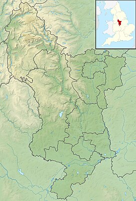
Peak District, England
Alport Height is a hill near Wirksworth in Derbyshire. It is a popular picnic site, since it has extensive views to the South, and is the first hill over 1,000 ft (300 m) within easy reach of the Derby area. Like Shining Cliff Woods, 2 km to the east, it is in the care of the National Trust. It was one of their first acquisitions in Derbyshire, acquired in 1930.
It is possible to see Derby city centre from the summit, as well as The Wrekin, the Long Mynd, and the Clee Hill. It is also possible to see the Sutton Coldfield and Lichfield masts, and the Birmingham city centre skyline, and also the Lickey Hills just beyond Birmingham. The Pye Green BT Tower on Cannock Chase can also be seen.
There are eight radio masts and associated buildings in a compound on the summit (not on Trust land).
The hill is sometimes known as Alport Stone after the name of the conspicuous pillar of quarried gritstone, some 20 ft (6.1 m) high, near its summit. The boulder has 3 or 4 recognised climbing routes up it, one being an 8 m route of climbing-grade E5. John Gill's bouldering website has early photographs of pioneer climbers in action on the Stone.[1][failed verification]

See also
- Alport Castles in the High Peak area
- Alport, a hamlet in the White Peak area
- v
- t
- e
Peaks of the Peak District of England
- Black Hill
- The Cloud
- Gun
- Kinder Scout
- Shining Tor

- Abney Low
- Aleck Low
- Allman Well Hill
- Alport Height
- Axe Edge Moor
- Back Tor
- Beeley Moor
- Big Moor
- Birchen Edge
- Blacka Moor
- Black Chew Head
- Black Edge
- Blake Low
- Blakelow Hill
- Bleaklow
- Bole Hill
- Bolehill
- Bosley Minn
- Britland Edge Hill
- Brittain's Plantation
- Brown Knoll
- Bunster Hill
- Burbage Edge
- Burton Bole End
- Calver Peak
- Cheeks Hill
- Chinley Churn
- Chrome Hill
- The Cloud
- Combs Moss
- Corbar Hill
- Croker Hill
- Crook Hill
- Dead Edge End
- Derwent Edge
- Durham Edge
- Eccles Pike
- Ecton Hill
- Eldon Hill
- Emlin
- Eyam Moor - Sir William Hill
- Featherbed Moss
- Featherbed Top
- Fin Cop
- Froggatt Edge
- Gardom's Edge
- Gautries Hill
- Gibraltar Rocks
- Gratton Hill
- Great Ridge
- Grindslow Knoll
- Grin Low
- Gun
- Harborough Rocks
- Hare Edge Hill
- Harridge Pike
- Hartcliff Hill
- Haven Hill
- Hawks Low
- The Height
- Heights of Abraham
- Higger Tor
- High Edge
- High Field
- High Low
- Hollins Hill
- High Neb
- High Wheeldon
- Higher Shelf Stones
- Hollins Cross
- Houndkirk Hill
- Lantern Pike
- Lees Moor
- Longstone Moor
- Lord's Seat
- Lose Hill
- Lost Lad
- Low Moor
- Mam Tor
- Margery Hill
- Merryton Low
- Middleton Moor
- Minninglow Hill
- Mount Famine
- Nelson's Monument
- Ossoms Hill
- Parkhouse Hill
- Pike Low
- Pikenaze Hill
- The Roaches
- Rock Hall
- Rushup Edge
- Sheen Hill
- Shutlingsloe
- Slipper Low
- Snailsden Pike End
- Snels Low
- South Head
- Sponds Hill
- Stanage Edge
- Stanton Moor
- Tegg's Nose
- Thorpe Cloud
- Totley Moor
- Ughill Height
- Wardlow Hay Cop
- West Nab
- Wetton Hill
- Whaley Moor
- Wibben Hill
- Wild Bank
- Win Hill
- Windgather Rocks
- Wire Stone
- Wolfscote Hill
References
- ^ Gill, John. "A Climbing Memoir: 1953–2008". Retrieved 6 January 2017.


