Čokešina
You can help expand this article with text translated from the corresponding article in Serbian. (August 2024) Click [show] for important translation instructions.
- Machine translation, like DeepL or Google Translate, is a useful starting point for translations, but translators must revise errors as necessary and confirm that the translation is accurate, rather than simply copy-pasting machine-translated text into the English Wikipedia.
- Do not translate text that appears unreliable or low-quality. If possible, verify the text with references provided in the foreign-language article.
- You must provide copyright attribution in the edit summary accompanying your translation by providing an interlanguage link to the source of your translation. A model attribution edit summary is
Content in this edit is translated from the existing Serbian Wikipedia article at [[:sr:Чокешина]]; see its history for attribution. - You may also add the template
{{Translated|sr|Чокешина}}to the talk page. - For more guidance, see Wikipedia:Translation.
Village in Mačva District, Serbia
Čokešina Чокешина (Serbian) | |
|---|---|
Village (Selo) | |
    | |
| 44°39′N 19°23′E / 44.650°N 19.383°E / 44.650; 19.383 | |
| Country |  Serbia Serbia |
| District | Mačva District |
| Municipality | Loznica |
| Population (2002) | |
| • Total | 881 |
| Time zone | UTC+1 (CET) |
| • Summer (DST) | UTC+2 (CEST) |
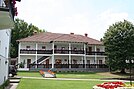
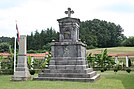
Čokešina is a village in the municipality of Loznica, Serbia. In the 2002 census, the village had a population of 881 people.[1]
References
- ^ Popis stanovništva, domaćinstava i Stanova 2002. Knjiga 1: Nacionalna ili etnička pripadnost po naseljima. Republika Srbija, Republički zavod za statistiku Beograd 2003. ISBN 86-84433-00-9
- v
- t
- e
City of Loznica
- Loznica (seat)
- Banja Koviljača
- Baščeluci
- Bradić
- Brezjak
- Brnjac
- Veliko Selo
- Voćnjak
- Gornja Badanja
- Gornja Borina
- Gornja Koviljača
- Gornja Sipulja
- Gornje Nedeljice
- Gornji Dobrić
- Grnčara
- Donja Badanja
- Donja Sipulja
- Donje Nedeljice
- Donji Dobrić
- Draginac
- Zajača
- Jadranska Lešnica
- Jarebice
- Jelav
- Joševa
- Jugovići
- Kamenica
- Klupci
- Kozjak
- Korenita
- Krajišnici
- Lešnica
- Lipnica
- Lipnički Šor
- Lozničko Polje
- Milina
- Meraja
- Novo Selo
- Paskovac
- Ploča
- Pomijača
- Ribarice
- Runjani
- Simino Brdo
- Slatina
- Straža
- Stupnica
- Tekeriš
- Trbosilje
- Trbušnica
- Tršić
- Filipovići
- Cikote
- Čokešina
- Šurice

Authority control databases | |
|---|---|
| International |
|
| National |
|
44°39′N 19°23′E / 44.650°N 19.383°E / 44.650; 19.383
 | This Mačva District, Serbia location article is a stub. You can help Wikipedia by expanding it. |
- v
- t
- e


